File:DETAIL VIEW OF SIDE STEEL RAIL, DECK, AND SHELF FROM SOUTHWEST CORNER - Price River Bridge, Spanning Price River, 760 North Street in Carbonville, 1 mile northwest of Price, HAER UTAH,4-CAVI,1-5.tif

Size of this JPG preview of this TIF file: 758 × 600 pixels. Other resolutions: 303 × 240 pixels | 607 × 480 pixels | 971 × 768 pixels | 1,280 × 1,013 pixels | 2,560 × 2,026 pixels | 5,000 × 3,957 pixels.
Original file (5,000 × 3,957 pixels, file size: 18.87 MB, MIME type: image/tiff)
Captions
Captions
Add a one-line explanation of what this file represents
Summary edit
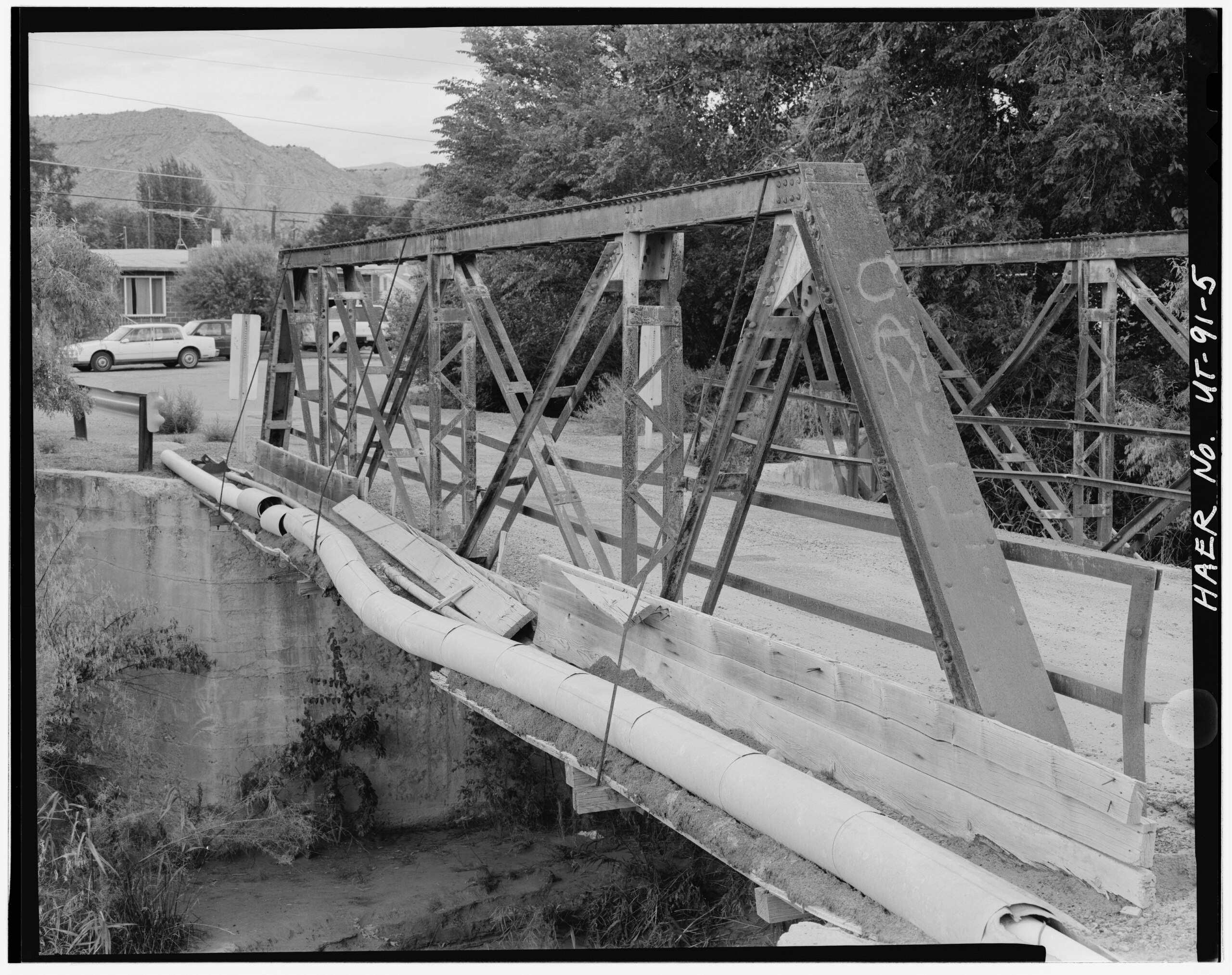
| DETAIL VIEW OF SIDE STEEL RAIL, DECK, AND SHELF FROM SOUTHWEST CORNER - Price River Bridge, Spanning Price River, 760 North Street in Carbonville, 1 mile northwest of Price, Carbonville, Carbon County, UT | ||||
|---|---|---|---|---|
| Title |
DETAIL VIEW OF SIDE STEEL RAIL, DECK, AND SHELF FROM SOUTHWEST CORNER - Price River Bridge, Spanning Price River, 760 North Street in Carbonville, 1 mile northwest of Price, Carbonville, Carbon County, UT |
|||
| Description |
Burke, James J; JBR Environmental Consultants, Inc., contractor; Clawson, Richard, photographer; Prince-Mahoney, Jenni, historian; Billat, Lorna, historian |
|||
| Depicted place | Utah; Carbon County; Carbonville | |||
| Date | Documentation compiled after 1968 | |||
| Dimensions | 4 x 5 in. | |||
| Current location |
Library of Congress Prints and Photographs Division Washington, D.C. 20540 USA http://hdl.loc.gov/loc.pnp/pp.print |
|||
| Accession number |
HAER UTAH,4-CAVI,1-5 |
|||
| Credit line |
|
|||
| Notes |
|
|||
| Source | https://www.loc.gov/pictures/item/ut0551.photos.367776p | |||
| Permission (Reusing this file) |
|
|||

| Object location | | View this and other nearby images on: OpenStreetMap |
|---|
File history
Click on a date/time to view the file as it appeared at that time.
| Date/Time | Thumbnail | Dimensions | User | Comment | |
|---|---|---|---|---|---|
| current | 02:44, 4 August 2014 |  | 5,000 × 3,957 (18.87 MB) | Fæ (talk | contribs) | GWToolset: Creating mediafile for Fæ. HABS 2014-08-02 (3401:3600) |
You cannot overwrite this file.
File usage on Commons
The following page uses this file: