File:DISTANT VIEW OF EAST FRONT - Central Baptist Church, 515 North Fourth Street, Muskogee, Muskogee County, OK HABS OKLA,51-MUSK,1-1.tif
Size of this JPG preview of this TIF file: 743 × 600 pixels. Other resolutions: 298 × 240 pixels | 595 × 480 pixels | 952 × 768 pixels | 1,269 × 1,024 pixels | 2,538 × 2,048 pixels | 5,000 × 4,035 pixels.
Original file (5,000 × 4,035 pixels, file size: 19.24 MB, MIME type: image/tiff)
Captions
Captions
Add a one-line explanation of what this file represents
Summary edit
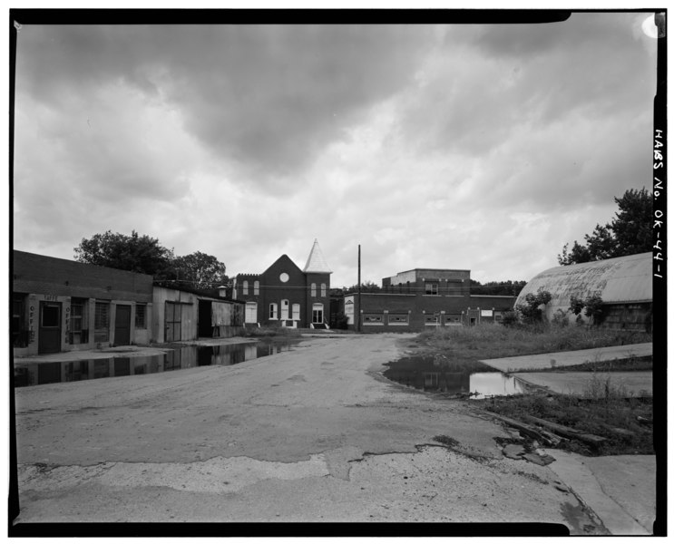
| DISTANT VIEW OF EAST FRONT - Central Baptist Church, 515 North Fourth Street, Muskogee, Muskogee County, OK | ||||
|---|---|---|---|---|
| Photographer |
Related names:
|
|||
| Title |
DISTANT VIEW OF EAST FRONT - Central Baptist Church, 515 North Fourth Street, Muskogee, Muskogee County, OK |
|||
| Depicted place | Oklahoma; Muskogee County; Muskogee | |||
| Date | Documentation compiled after 1933 | |||
| Dimensions | 4 x 5 in. | |||
| Current location |
Library of Congress Prints and Photographs Division Washington, D.C. 20540 USA http://hdl.loc.gov/loc.pnp/pp.print |
|||
| Accession number |
HABS OKLA,51-MUSK,1-1 |
|||
| Credit line |
|
|||
| Notes |
|
|||
| Source | https://www.loc.gov/pictures/item/ok0047.photos.129470p | |||
| Permission (Reusing this file) |
|
|||

| Object location | | View this and other nearby images on: OpenStreetMap |
|---|
File history
Click on a date/time to view the file as it appeared at that time.
| Date/Time | Thumbnail | Dimensions | User | Comment | |
|---|---|---|---|---|---|
| current | 03:03, 2 August 2014 |  | 5,000 × 4,035 (19.24 MB) | Fæ (talk | contribs) | GWToolset: Creating mediafile for Fæ. HABS 2014-08-01 2601-2900 missing |
You cannot overwrite this file.
File usage on Commons
The following page uses this file: