File:Detail view of headframe, from within the Orphan Mine Site, view to east-southeast - Orphan Lode Mine, Headframe, North of West Rim Road between Powell Point and Maricopa Point, South HAER AZ-67-A-8.tif
Size of this JPG preview of this TIF file: 745 × 599 pixels. Other resolutions: 298 × 240 pixels | 597 × 480 pixels | 955 × 768 pixels | 1,273 × 1,024 pixels | 2,546 × 2,048 pixels | 5,108 × 4,109 pixels.
Original file (5,108 × 4,109 pixels, file size: 40.06 MB, MIME type: image/tiff)
Captions
Captions
Add a one-line explanation of what this file represents
Summary edit
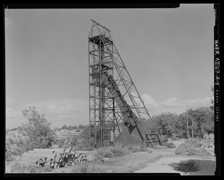
| Detail view of headframe, from within the Orphan Mine Site, view to east-southeast - Orphan Lode Mine, Headframe, North of West Rim Road between Powell Point and Maricopa Point, South Rim, Grand Canyon Village, Coconino County, AZ | ||||
|---|---|---|---|---|
| Photographer |
Killam, David Related names:
|
|||
| Title |
Detail view of headframe, from within the Orphan Mine Site, view to east-southeast - Orphan Lode Mine, Headframe, North of West Rim Road between Powell Point and Maricopa Point, South Rim, Grand Canyon Village, Coconino County, AZ |
|||
| Depicted place | Arizona; Coconino County; Grand Canyon Village | |||
| Date | 2005 | |||
| Dimensions | 4 x 5 in. | |||
| Current location |
Library of Congress Prints and Photographs Division Washington, D.C. 20540 USA http://hdl.loc.gov/loc.pnp/pp.print |
|||
| Accession number |
HAER AZ-67-A-8 |
|||
| Credit line |
|
|||
| Notes |
|
|||
| Source | https://www.loc.gov/pictures/item/az0500.photos.575135p | |||
| Permission (Reusing this file) |
|
|||

| Object location | | View this and other nearby images on: OpenStreetMap |
|---|
File history
Click on a date/time to view the file as it appeared at that time.
| Date/Time | Thumbnail | Dimensions | User | Comment | |
|---|---|---|---|---|---|
| current | 22:34, 1 July 2014 |  | 5,108 × 4,109 (40.06 MB) | Fæ (talk | contribs) | GWToolset: Creating mediafile for Fæ. HABS 1 July 2014 (201:300) |
You cannot overwrite this file.
File usage on Commons
The following page uses this file: