File:ELEVATION, LOOKING EAST, MIDDLE 1-3 - Vermillion County Bridge No. 120, Spanning Little Vermillion River at Main Street, Newport, Vermillion County, IN HAER IND,83-NEWP,2-5.tif
Size of this JPG preview of this TIF file: 738 × 599 pixels. Other resolutions: 296 × 240 pixels | 591 × 480 pixels | 946 × 768 pixels | 1,261 × 1,024 pixels | 2,522 × 2,048 pixels | 5,000 × 4,060 pixels.
Original file (5,000 × 4,060 pixels, file size: 19.36 MB, MIME type: image/tiff)
Captions
Captions
Add a one-line explanation of what this file represents
Summary edit
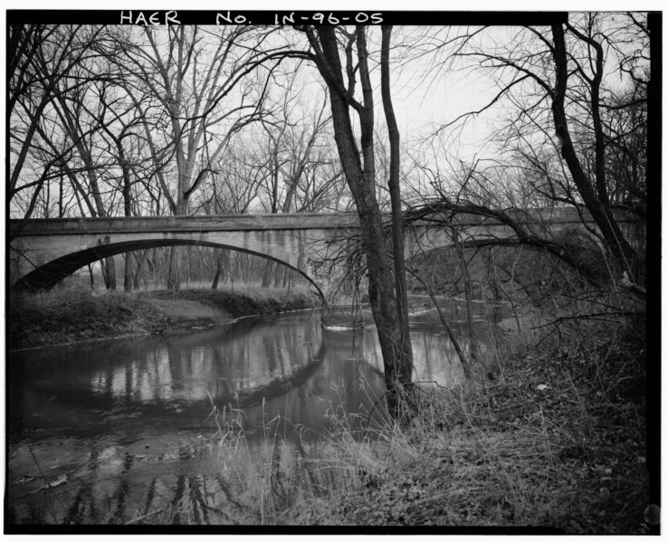
| ELEVATION, LOOKING EAST, MIDDLE 1-3 - Vermillion County Bridge No. 120, Spanning Little Vermillion River at Main Street, Newport, Vermillion County, IN | ||||
|---|---|---|---|---|
| Title |
ELEVATION, LOOKING EAST, MIDDLE 1-3 - Vermillion County Bridge No. 120, Spanning Little Vermillion River at Main Street, Newport, Vermillion County, IN |
|||
| Depicted place | Indiana; Vermillion County; Newport | |||
| Date | Documentation compiled after 1968 | |||
| Dimensions | 4 x 5 in. | |||
| Current location |
Library of Congress Prints and Photographs Division Washington, D.C. 20540 USA http://hdl.loc.gov/loc.pnp/pp.print |
|||
| Accession number |
HAER IND,83-NEWP,2-5 |
|||
| Credit line |
|
|||
| Notes |
|
|||
| Source | https://www.loc.gov/pictures/item/in0426.photos.319231p | |||
| Permission (Reusing this file) |
|
|||

| Object location | | View this and other nearby images on: OpenStreetMap |
|---|
File history
Click on a date/time to view the file as it appeared at that time.
| Date/Time | Thumbnail | Dimensions | User | Comment | |
|---|---|---|---|---|---|
| current | 20:03, 18 July 2014 |  | 5,000 × 4,060 (19.36 MB) | Fæ (talk | contribs) | GWToolset: Creating mediafile for Fæ. HABS 16 July 2014 (1201:1400) |
You cannot overwrite this file.
File usage on Commons
The following page uses this file: