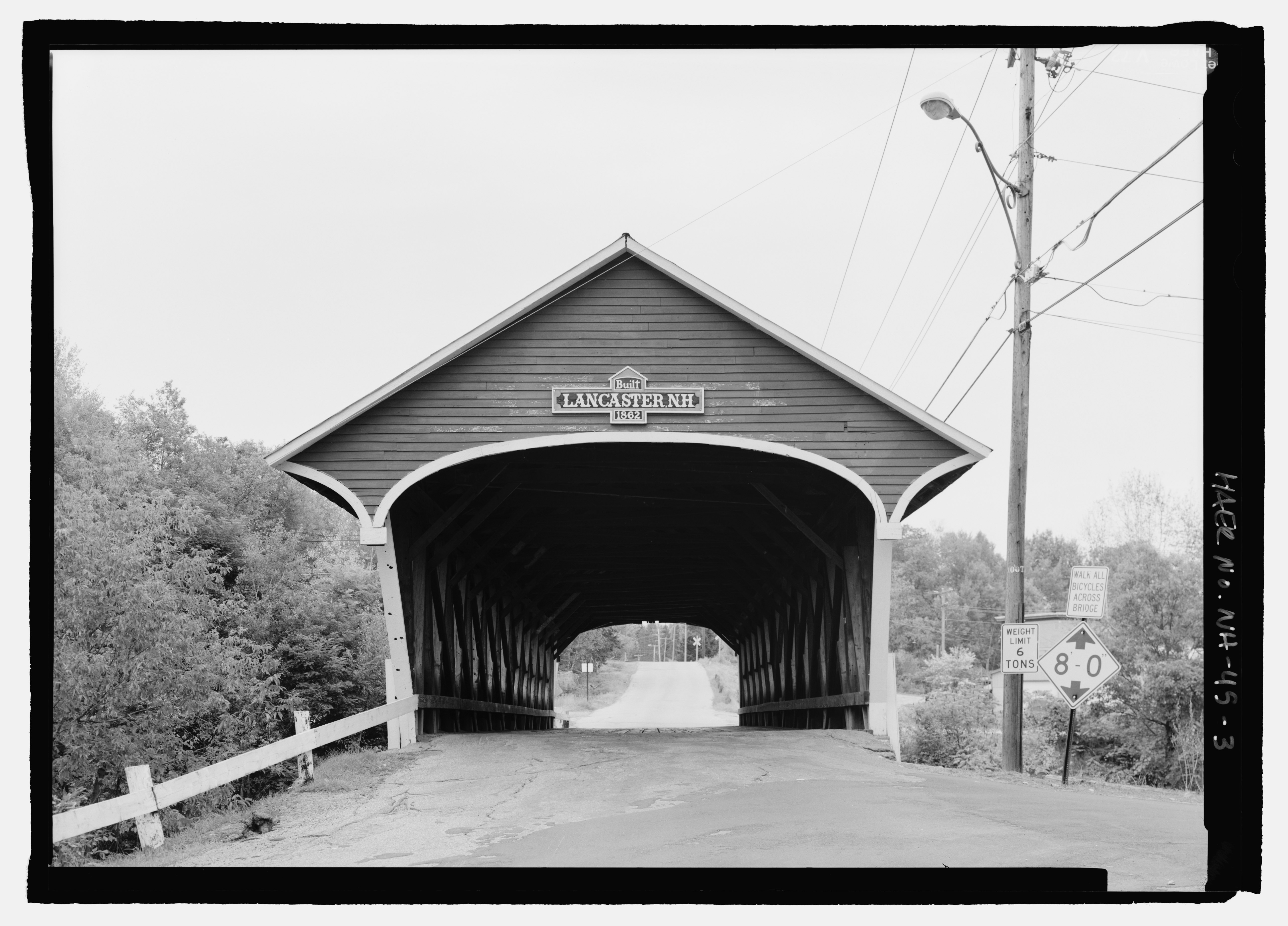
File:ELEVATION, WEST PORTAL. - Mechanic Street Bridge, Spanning Israel River, Lancaster, Coos County, NH HAER NH-45-3.tif

Size of this JPG preview of this TIF file: 800 × 575 pixels. Other resolutions: 320 × 230 pixels | 640 × 460 pixels | 1,024 × 736 pixels | 1,280 × 920 pixels | 2,560 × 1,841 pixels | 5,173 × 3,720 pixels.
Original file (5,173 × 3,720 pixels, file size: 18.35 MB, MIME type: image/tiff)
Captions
Captions
Add a one-line explanation of what this file represents
Summary edit
| ELEVATION, WEST PORTAL. - Mechanic Street Bridge, Spanning Israel River, Lancaster, Coos County, NH | ||||
|---|---|---|---|---|
| Photographer |
Lowe, Jet Related names:
|
|||
| Title |
ELEVATION, WEST PORTAL. - Mechanic Street Bridge, Spanning Israel River, Lancaster, Coos County, NH |
|||
| Depicted place | New Hampshire; Coos County; Lancaster | |||
| Date | 2004 | |||
| Dimensions | 5 x 7 in. | |||
| Current location |
Library of Congress Prints and Photographs Division Washington, D.C. 20540 USA http://hdl.loc.gov/loc.pnp/pp.print |
|||
| Accession number |
HAER NH-45-3 |
|||
| Credit line |
|
|||
| Notes |
|
|||
| Source | https://www.loc.gov/pictures/item/nh0284.photos.198825p | |||
| Permission (Reusing this file) |
|
|||

| Object location | | View this and other nearby images on: OpenStreetMap |
|---|
File history
Click on a date/time to view the file as it appeared at that time.
| Date/Time | Thumbnail | Dimensions | User | Comment | |
|---|---|---|---|---|---|
| current | 06:29, 29 July 2014 |  | 5,173 × 3,720 (18.35 MB) | Fæ (talk | contribs) | GWToolset: Creating mediafile for Fæ. HABS 24 July 2014 (2001:2300) |
You cannot overwrite this file.
File usage on Commons
The following page uses this file:
File usage on other wikis
The following other wikis use this file:
- Usage on ja.wikipedia.org