File:EXTERIOR VIEW WITH APPROACH TRESTLE, TUSCALOOSA SIDE. - Gulf, Mobile and Ohio Railroad Bridge, Spans Black Warrior River between Northport and Tuscaloosa, Tuscaloosa, Tuscaloosa HAER ALA,63-TUSLO,27-3.tif

Size of this JPG preview of this TIF file: 742 × 600 pixels. Other resolutions: 297 × 240 pixels | 594 × 480 pixels | 950 × 768 pixels | 1,266 × 1,024 pixels | 2,533 × 2,048 pixels | 4,948 × 4,001 pixels.
Original file (4,948 × 4,001 pixels, file size: 18.88 MB, MIME type: image/tiff)
Captions
Captions
Add a one-line explanation of what this file represents
Summary edit
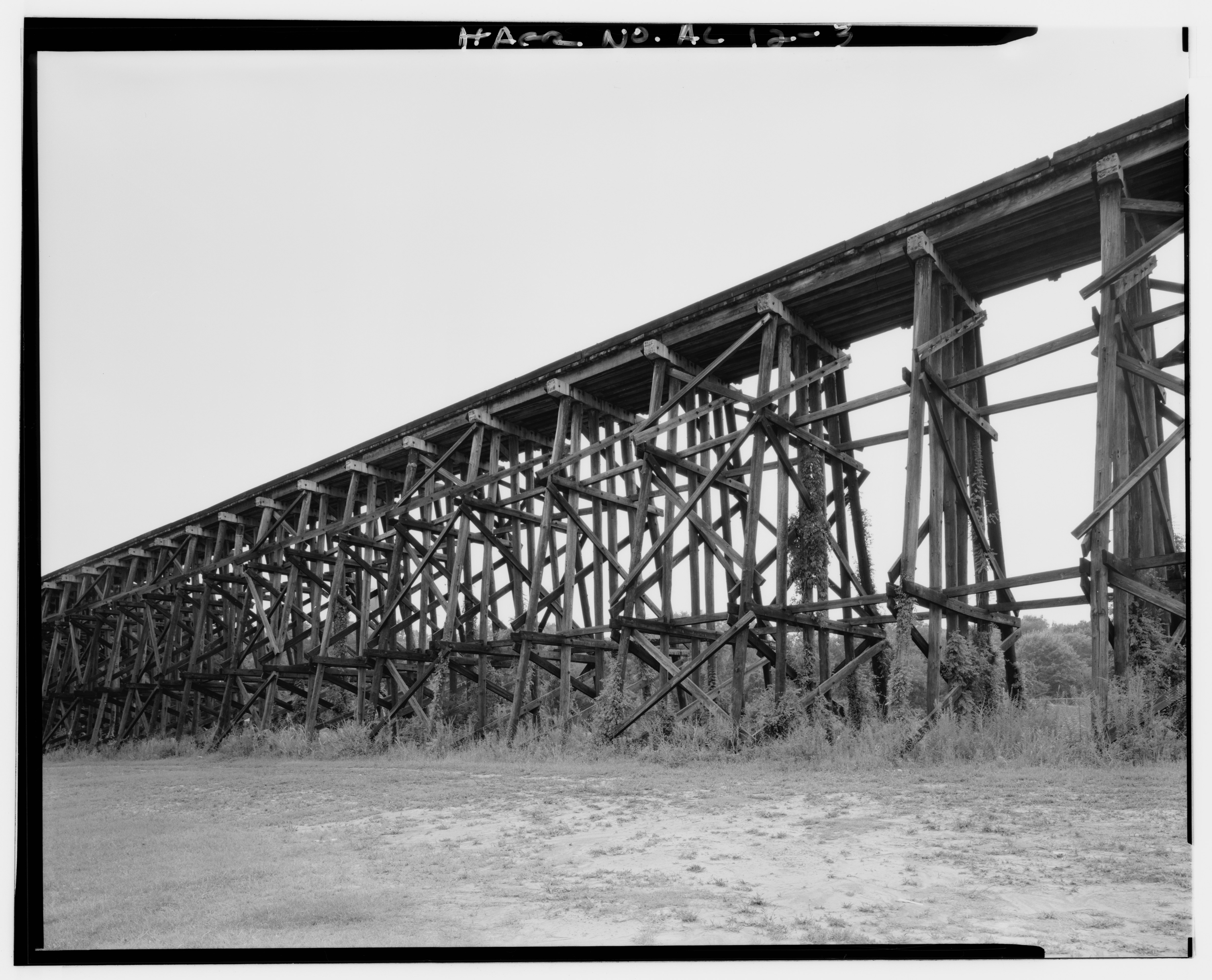
| EXTERIOR VIEW WITH APPROACH TRESTLE, TUSCALOOSA SIDE. - Gulf, Mobile and Ohio Railroad Bridge, Spans Black Warrior River between Northport and Tuscaloosa, Tuscaloosa, Tuscaloosa County, AL | ||||
|---|---|---|---|---|
| Photographer |
Deising, David Related names:
|
|||
| Title |
EXTERIOR VIEW WITH APPROACH TRESTLE, TUSCALOOSA SIDE. - Gulf, Mobile and Ohio Railroad Bridge, Spans Black Warrior River between Northport and Tuscaloosa, Tuscaloosa, Tuscaloosa County, AL |
|||
| Depicted place | Alabama; Tuscaloosa County; Tuscaloosa | |||
| Date | 1992 | |||
| Dimensions | 4 x 5 in. | |||
| Current location |
Library of Congress Prints and Photographs Division Washington, D.C. 20540 USA http://hdl.loc.gov/loc.pnp/pp.print |
|||
| Accession number |
HAER ALA,63-TUSLO,27-3 |
|||
| Credit line |
|
|||
| Notes |
|
|||
| References |
|
|||
| Source | https://www.loc.gov/pictures/item/al0909.photos.045811p | |||
| Permission (Reusing this file) |
|
|||

| Object location | | View this and other nearby images on: OpenStreetMap |
|---|
File history
Click on a date/time to view the file as it appeared at that time.
| Date/Time | Thumbnail | Dimensions | User | Comment | |
|---|---|---|---|---|---|
| current | 14:25, 30 June 2014 |  | 4,948 × 4,001 (18.88 MB) | Fæ (talk | contribs) | GWToolset: Creating mediafile for Fæ. HABS batch upload 29 June 2014 (101:150) |
You cannot overwrite this file.
File usage on Commons
The following page uses this file: