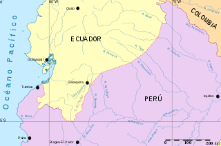
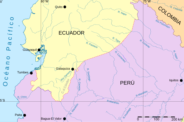
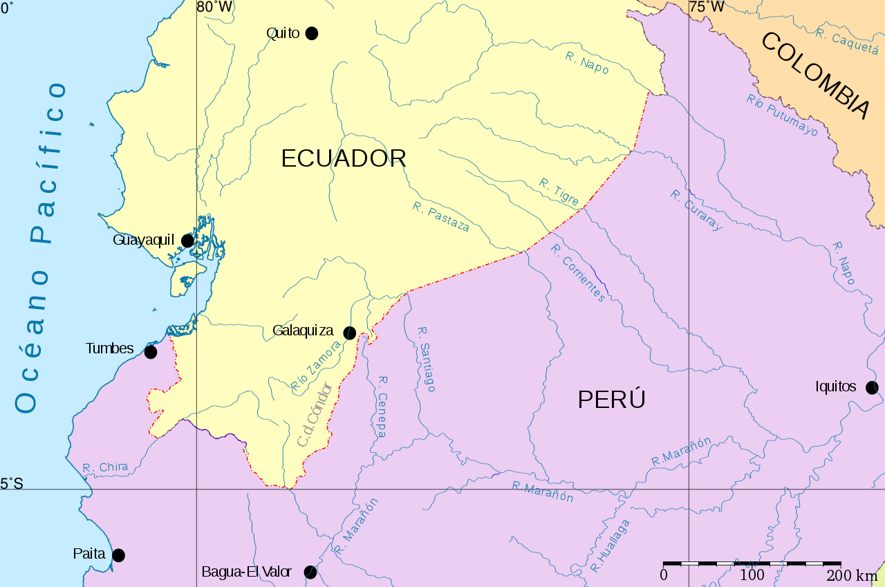
File:Ecuador-Peru-Frontera.svg

Size of this PNG preview of this SVG file: 800 × 531 pixels. Other resolutions: 320 × 212 pixels | 640 × 424 pixels | 1,024 × 679 pixels | 1,280 × 849 pixels | 2,560 × 1,698 pixels | 885 × 587 pixels.
Original file (SVG file, nominally 885 × 587 pixels, file size: 571 KB)
Captions
Captions
Add a one-line explanation of what this file represents
Summary edit
| Description |
Español: Frontera Ecuador-Peru segun Generic Mapping Tools en 2011 |
| Date | |
| Source | Own work |
| Author | Createaccount |
The map has been created with the Generic Mapping Tools: https://www.generic-mapping-tools.org/ using one or more of these public-domain datasets for the relief:
|

|
Permission is granted to copy, distribute and/or modify this document under the terms of the GNU Free Documentation License, Version 1.2 or any later version published by the Free Software Foundation; with no Invariant Sections, no Front-Cover Texts, and no Back-Cover Texts. A copy of the license is included in the section entitled GNU Free Documentation License. |
Licensing edit
I, the copyright holder of this work, hereby publish it under the following license:
This file is licensed under the Creative Commons Attribution-Share Alike 3.0 Unported license.
- You are free:
- to share – to copy, distribute and transmit the work
- to remix – to adapt the work
- Under the following conditions:
- attribution – You must give appropriate credit, provide a link to the license, and indicate if changes were made. You may do so in any reasonable manner, but not in any way that suggests the licensor endorses you or your use.
- share alike – If you remix, transform, or build upon the material, you must distribute your contributions under the same or compatible license as the original.
File history
Click on a date/time to view the file as it appeared at that time.
| Date/Time | Thumbnail | Dimensions | User | Comment | |
|---|---|---|---|---|---|
| current | 15:39, 8 January 2018 | | 885 × 587 (571 KB) | Milenioscuro (talk | contribs) | mejoras en el mapa, colores según convenciones |
| 19:50, 28 August 2012 |  | 885 × 587 (751 KB) | Ras67 (talk | contribs) | black frame removed, text ''Río Zamora'' disconnected from path | |
| 19:45, 11 June 2011 |  | 887 × 589 (754 KB) | Keysanger (talk | contribs) | Rio Corrientes und Curaray added | |
| 17:43, 5 June 2011 |  | 887 × 589 (752 KB) | Keysanger (talk | contribs) |
You cannot overwrite this file.
File usage on Commons
The following page uses this file:
.svg)
File usage on other wikis
The following other wikis use this file:
- Usage on az.wikipedia.org
- Usage on bn.wikipedia.org
- Usage on ca.wikipedia.org
- Usage on cs.wikipedia.org
- Usage on en.wikipedia.org
- Usage on eo.wikipedia.org
- Usage on es.wikipedia.org
- Usage on eu.wikipedia.org
- Usage on fr.wikipedia.org
- Usage on it.wikipedia.org
- Usage on ka.wikipedia.org
- Usage on pnb.wikipedia.org
- Usage on pt.wikipedia.org
- Usage on qu.wikipedia.org
- Usage on ro.wikipedia.org
- Usage on sv.wikipedia.org
- Usage on uk.wikipedia.org
- Usage on vi.wikipedia.org
- Usage on www.wikidata.org
- Usage on zh.wikipedia.org