File:GENERAL VIEW OF COMPLEX (drawing from History of San Diego County, California, published 1883. Photocopy 1975 by Bert Shankland, San Diego). - Johnson-Taylor Ranch House, Black HABS CAL,37-RANPE,1-1.tif

Size of this JPG preview of this TIF file: 753 × 599 pixels. Other resolutions: 302 × 240 pixels | 603 × 480 pixels | 965 × 768 pixels | 1,280 × 1,019 pixels | 2,560 × 2,038 pixels | 4,976 × 3,961 pixels.
Original file (4,976 × 3,961 pixels, file size: 18.8 MB, MIME type: image/tiff)
Captions
Captions
Add a one-line explanation of what this file represents
Summary edit
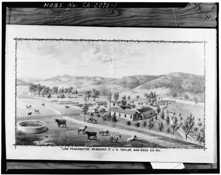
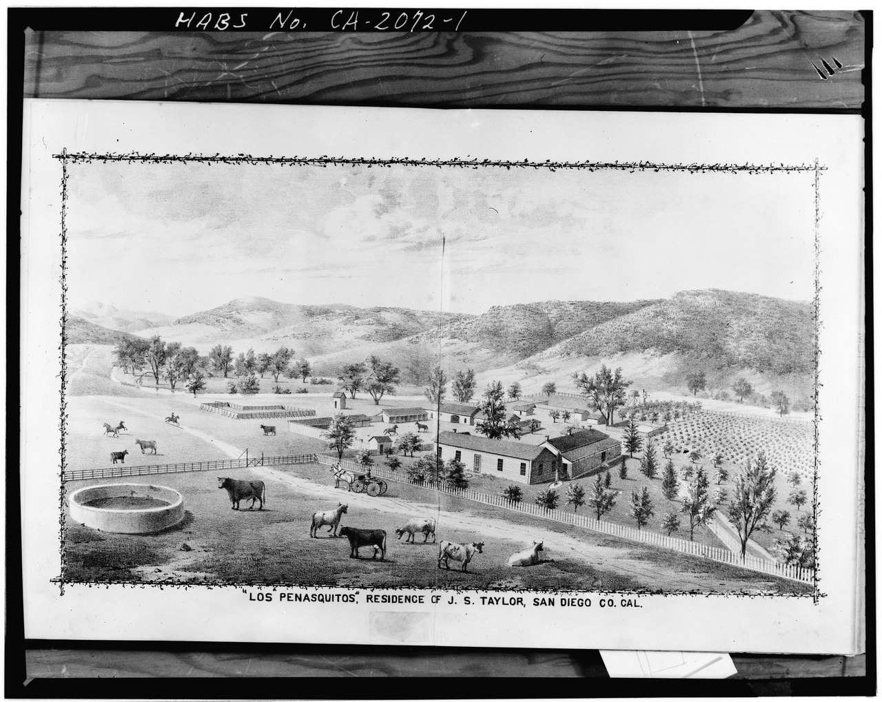
| GENERAL VIEW OF COMPLEX (drawing from History of San Diego County, California, published 1883. Photocopy 1975 by Bert Shankland, San Diego). - Johnson-Taylor Ranch House, Black Mountain Road vicinity, Rancho Penasquitos, San Diego County, CA | ||||
|---|---|---|---|---|
| Title |
GENERAL VIEW OF COMPLEX (drawing from History of San Diego County, California, published 1883. Photocopy 1975 by Bert Shankland, San Diego). - Johnson-Taylor Ranch House, Black Mountain Road vicinity, Rancho Penasquitos, San Diego County, CA |
|||
| Depicted place | California; San Diego County; Rancho Penasquitos | |||
| Date | Documentation compiled after 1933 | |||
| Dimensions | 4 x 5 in. | |||
| Current location |
Library of Congress Prints and Photographs Division Washington, D.C. 20540 USA http://hdl.loc.gov/loc.pnp/pp.print |
|||
| Accession number |
HABS CAL,37-RANPE,1-1 |
|||
| Credit line |
|
|||
| Notes |
|
|||
| Source | https://www.loc.gov/pictures/item/ca0598.photos.015244p | |||
| Permission (Reusing this file) |
|
|||

| Object location | | View this and other nearby images on: OpenStreetMap |
|---|
File history
Click on a date/time to view the file as it appeared at that time.
| Date/Time | Thumbnail | Dimensions | User | Comment | |
|---|---|---|---|---|---|
| current | 17:45, 3 July 2014 |  | 4,976 × 3,961 (18.8 MB) | Fæ (talk | contribs) | GWToolset: Creating mediafile for Fæ. HABS 3 July 2014 (201:300) |
You cannot overwrite this file.
File usage on Commons
The following page uses this file: