File:GENERAL VIEW OF DAM LOOKING UPSTREAM (SOUTH) FROM 'DRYER HILL'. - Hume Lake Dam, Sequioa National Forest, Hume, Fresno County, CA HAER CAL,10-HUME,1-1.tif

Size of this JPG preview of this TIF file: 758 × 600 pixels. Other resolutions: 303 × 240 pixels | 607 × 480 pixels | 971 × 768 pixels | 1,280 × 1,013 pixels | 2,560 × 2,025 pixels | 4,673 × 3,697 pixels.
Original file (4,673 × 3,697 pixels, file size: 16.48 MB, MIME type: image/tiff)
Captions
Captions
Add a one-line explanation of what this file represents
Summary edit
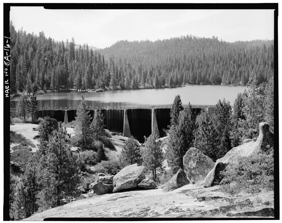
| GENERAL VIEW OF DAM LOOKING UPSTREAM (SOUTH) FROM 'DRYER HILL'. - Hume Lake Dam, Sequioa National Forest, Hume, Fresno County, CA | ||||
|---|---|---|---|---|
| Photographer |
Frear, Richard K. Related names:
|
|||
| Title |
GENERAL VIEW OF DAM LOOKING UPSTREAM (SOUTH) FROM 'DRYER HILL'. - Hume Lake Dam, Sequioa National Forest, Hume, Fresno County, CA |
|||
| Depicted place | California; Fresno County; Hume | |||
| Date | 1982 | |||
| Dimensions | 4 x 5 in. | |||
| Current location |
Library of Congress Prints and Photographs Division Washington, D.C. 20540 USA http://hdl.loc.gov/loc.pnp/pp.print |
|||
| Accession number |
HAER CAL,10-HUME,1-1 |
|||
| Credit line |
|
|||
| Notes |
|
|||
| Source | https://www.loc.gov/pictures/item/ca1294.photos.011016p | |||
| Permission (Reusing this file) |
|
|||

| Camera location | | View this and other nearby images on: OpenStreetMap |
|---|
File history
Click on a date/time to view the file as it appeared at that time.
| Date/Time | Thumbnail | Dimensions | User | Comment | |
|---|---|---|---|---|---|
| current | 19:54, 2 July 2014 |  | 4,673 × 3,697 (16.48 MB) | Fæ (talk | contribs) | GWToolset: Creating mediafile for Fæ. HABS batch upload 2 July 2014 (301:400) |
You cannot overwrite this file.
File usage on Commons
The following page uses this file: