File:GENERAL VIEW OF THE BRIDGE FROM THE SOUTHWEST - Susquehanna River Bridge, Spanning Susquehanna River, Havre de Grace, Harford County, MD HAER MD,13-HAV,4-1.tif

Size of this JPG preview of this TIF file: 777 × 600 pixels. Other resolutions: 311 × 240 pixels | 622 × 480 pixels | 995 × 768 pixels | 1,280 × 988 pixels | 2,560 × 1,976 pixels | 5,299 × 4,091 pixels.
Original file (5,299 × 4,091 pixels, file size: 20.68 MB, MIME type: image/tiff)
Captions
Captions
Add a one-line explanation of what this file represents
Summary edit
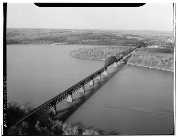
| GENERAL VIEW OF THE BRIDGE FROM THE SOUTHWEST - Susquehanna River Bridge, Spanning Susquehanna River, Havre de Grace, Harford County, MD
( |
||||||||||||||||||||||||||
|---|---|---|---|---|---|---|---|---|---|---|---|---|---|---|---|---|---|---|---|---|---|---|---|---|---|---|
| Photographer |
|
|||||||||||||||||||||||||
| Title |
GENERAL VIEW OF THE BRIDGE FROM THE SOUTHWEST - Susquehanna River Bridge, Spanning Susquehanna River, Havre de Grace, Harford County, MD |
|||||||||||||||||||||||||
| Description |
American Bridge Company |
|||||||||||||||||||||||||
| Depicted place | Maryland; Harford County; Havre de Grace | |||||||||||||||||||||||||
| Date | 1978 | |||||||||||||||||||||||||
| Dimensions | 4 x 5 in. | |||||||||||||||||||||||||
| Current location |
Library of Congress Prints and Photographs Division Washington, D.C. 20540 USA |
|||||||||||||||||||||||||
| Accession number |
HAER MD,13-HAV,4-1 |
|||||||||||||||||||||||||
| Credit line |
|
|||||||||||||||||||||||||
| Notes |
|
|||||||||||||||||||||||||
| Source |
|
|||||||||||||||||||||||||
| Permission (Reusing this file) |
|
|||||||||||||||||||||||||


| Object location | | View this and other nearby images on: OpenStreetMap |
|---|
File history
Click on a date/time to view the file as it appeared at that time.
| Date/Time | Thumbnail | Dimensions | User | Comment | |
|---|---|---|---|---|---|
| current | 16:35, 22 July 2014 |  | 5,299 × 4,091 (20.68 MB) | Fæ (talk | contribs) | GWToolset: Creating mediafile for Fæ. HABS 21 July 2014 (1601:1800) |
You cannot overwrite this file.
File usage on Commons
The following page uses this file: