File:General oblique view- east side of south end, from the Dos Hermanos Highway Bridge - Puente Guillermo Esteves, Spanning San Antonio Channel at PR-25 (Juan Ponce de Leon Avenue), HAER PR,7-SAJU,61-8.tif

Size of this JPG preview of this TIF file: 747 × 600 pixels. Other resolutions: 299 × 240 pixels | 598 × 480 pixels | 957 × 768 pixels | 1,276 × 1,024 pixels | 2,551 × 2,048 pixels | 5,000 × 4,014 pixels.
Original file (5,000 × 4,014 pixels, file size: 19.14 MB, MIME type: image/tiff)
Captions
Captions
Add a one-line explanation of what this file represents
Summary
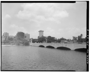
edit| General oblique view- east side of south end, from the Dos Hermanos Highway Bridge - Puente Guillermo Esteves, Spanning San Antonio Channel at PR-25 (Juan Ponce de Leon Avenue), San Juan, San Juan Municipio, PR | ||||
|---|---|---|---|---|
| Photographer |
Mendez-Caratini, Hector, creator |
|||
| Title |
General oblique view- east side of south end, from the Dos Hermanos Highway Bridge - Puente Guillermo Esteves, Spanning San Antonio Channel at PR-25 (Juan Ponce de Leon Avenue), San Juan, San Juan Municipio, PR |
|||
| Depicted place | Puerto Rico; San Juan Municipio; San Juan | |||
| Date | 1995 | |||
| Dimensions | 4 x 5 in. | |||
| Current location |
Library of Congress Prints and Photographs Division Washington, D.C. 20540 USA http://hdl.loc.gov/loc.pnp/pp.print |
|||
| Accession number |
HAER PR,7-SAJU,61-8 |
|||
| Credit line |
|
|||
| Notes |
|
|||
| Source | https://www.loc.gov/pictures/item/pr1475.photos.362811p | |||
| Permission (Reusing this file) |
|
|||

File history
Click on a date/time to view the file as it appeared at that time.
| Date/Time | Thumbnail | Dimensions | User | Comment | |
|---|---|---|---|---|---|
| current | 12:51, 1 August 2014 |  | 5,000 × 4,014 (19.14 MB) | Fæ (talk | contribs) | GWToolset: Creating mediafile for Fæ. HABS 31 July 2014 (3000:3200) |
You cannot overwrite this file.
File usage on Commons
The following page uses this file:
File usage on other wikis
The following other wikis use this file:
- Usage on en.wikipedia.org