File:Glasserton Dumfries and Galloway UK parish map.svg

Size of this PNG preview of this SVG file: 800 × 544 pixels. Other resolutions: 320 × 218 pixels | 640 × 435 pixels | 1,024 × 696 pixels | 1,280 × 870 pixels | 2,560 × 1,741 pixels | 1,425 × 969 pixels.
Original file (SVG file, nominally 1,425 × 969 pixels, file size: 1.86 MB)
Captions
Captions
Add a one-line explanation of what this file represents
Summary edit
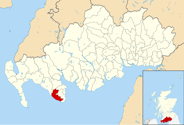
| Description | Map of Glasserton Parish, Dumfries and Galloway, UK. Equirectangular map projection on WGS 84 datum, with N/S stretched 170% Geographic limits: *West: 5.25W *East: 2.75W *North: 55.50N *South: 54.50N |
| Date | (UTC) |
| Source |
This file was derived from: Dumfries and Galloway UK parish map (blank).svg: |
| Author |
|
.svg)
| This is a retouched picture, which means that it has been digitally altered from its original version. Modifications: Shaded Glasserton parish. The original can be viewed here: Dumfries and Galloway UK parish map (blank).svg:
|
Licensing edit
I, the copyright holder of this work, hereby publish it under the following license:
This file is licensed under the Creative Commons Attribution-Share Alike 3.0 Unported license.
- You are free:
- to share – to copy, distribute and transmit the work
- to remix – to adapt the work
- Under the following conditions:
- attribution – You must give appropriate credit, provide a link to the license, and indicate if changes were made. You may do so in any reasonable manner, but not in any way that suggests the licensor endorses you or your use.
- share alike – If you remix, transform, or build upon the material, you must distribute your contributions under the same or compatible license as the original.
Original upload log edit
This image is a derivative work of the following images:
- File:Dumfries_and_Galloway_UK_parish_map_(blank).svg licensed with Cc-by-sa-3.0
- 2013-11-09T22:55:41Z Nilfanion 1425x969 (1952997 Bytes) {{Information |Description=Blank map of [[w:Dumfries and Galloway|Dumfries and Galloway]], UK with parishes shown. Equirectangular map projection on WGS 84 datum, with N/S stretched 170% Geographic limits: *West: 5.25W *Eas
Uploaded with derivativeFX
File history
Click on a date/time to view the file as it appeared at that time.
| Date/Time | Thumbnail | Dimensions | User | Comment | |
|---|---|---|---|---|---|
| current | 10:54, 12 November 2013 | | 1,425 × 969 (1.86 MB) | Jonathan Oldenbuck (talk | contribs) | == {{int:filedesc}} == {{Information |Description=Map of Glasserton Parish, Dumfries and Galloway, UK. Equirectangular map projection on WGS 84 datum, with N/S stretched 170% Geographic limits: *West: 5.25W *East: 2.75W *N... |
You cannot overwrite this file.
File usage on Commons
There are no pages that use this file.