File:Historic American Buildings Survey Willis Foster, Photographer Northern California Writers' Project Original- February 1940 Re-photo- August 1940 - Henry Hotel, Mount Diablo Road HABS CAL,7-ALAMO,1-1.tif

Size of this JPG preview of this TIF file: 800 × 575 pixels. Other resolutions: 320 × 230 pixels | 640 × 460 pixels | 1,024 × 736 pixels | 1,280 × 920 pixels | 2,560 × 1,841 pixels | 5,000 × 3,595 pixels.
Original file (5,000 × 3,595 pixels, file size: 17.14 MB, MIME type: image/tiff)
Captions
Captions
Add a one-line explanation of what this file represents
Summary edit
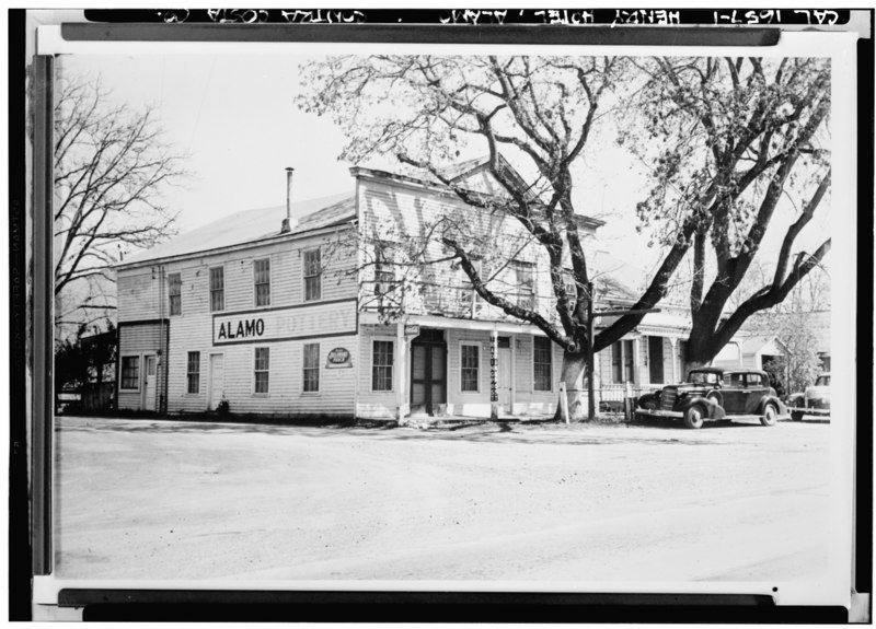
| Historic American Buildings Survey Willis Foster, Photographer Northern California Writers' Project Original- February 1940 Re-photo- August 1940 - Henry Hotel, Mount Diablo Road and Highwat 21, Alamo, Contra Costa County, CA | ||||
|---|---|---|---|---|
| Title |
Historic American Buildings Survey Willis Foster, Photographer Northern California Writers' Project Original- February 1940 Re-photo- August 1940 - Henry Hotel, Mount Diablo Road and Highwat 21, Alamo, Contra Costa County, CA |
|||
| Description |
Henry Hotel — in Alamo, on the Mount Diablo Road, Contra Costa County, California (1940). |
|||
| Depicted place | California; Contra Costa County; Alamo | |||
| Dimensions | 5 x 7 in. | |||
| Collection | HABS—Historic American Buildings Survey of California | |||
| Current location |
Library of Congress Prints and Photographs Division Washington, D.C. 20540 USA http://hdl.loc.gov/loc.pnp/pp.print |
|||
| Accession number |
HABS CAL,7-ALAMO,1-1 |
|||
| Credit line |
|
|||
| Source | https://www.loc.gov/pictures/item/ca0117.photos.020321p | |||
| Permission (Reusing this file) |
|
|||

| Camera location | | View this and other nearby images on: OpenStreetMap |
|---|
File history
Click on a date/time to view the file as it appeared at that time.
| Date/Time | Thumbnail | Dimensions | User | Comment | |
|---|---|---|---|---|---|
| current | 03:35, 2 July 2014 |  | 5,000 × 3,595 (17.14 MB) | Fæ (talk | contribs) | GWToolset: Creating mediafile for Fæ. HABS 1 July 2014 (201:300) |
You cannot overwrite this file.
File usage on Commons
The following page uses this file: