File:Instrumentation and control building, architectural, floor plans. Specifications no. Eng-04-353-55-72; Drawing No. 60-09-12' sheet 64 of 148; file no. 1321-15. Stamped- record HAER CAL,15-BORON.V,4E-6.tif

Size of this JPG preview of this TIF file: 744 × 599 pixels. Other resolutions: 298 × 240 pixels | 596 × 480 pixels | 954 × 768 pixels | 1,272 × 1,024 pixels | 2,543 × 2,048 pixels | 5,560 × 4,478 pixels.
Original file (5,560 × 4,478 pixels, file size: 23.75 MB, MIME type: image/tiff)
Captions
Captions
Add a one-line explanation of what this file represents
Summary edit
| Photographer |
De Vries, David |
|||
| Title |
Instrumentation and control building, architectural, floor plans. Specifications no. Eng-04-353-55-72; Drawing No. 60-09-12' sheet 64 of 148; file no. 1321-15. Stamped- record drawing - as constructed. Below stamp- Contract no. 4338, no change. - Edwards Air Force Base, Air Force Rocket Propulsion Laboratory, Control Center, Test Area 1-115, near Altair and Saturn Boulevards, Boron, Kern County, CA |
|||
| Depicted place | California; Kern County; Boron | |||
| Date | 1997 | |||
| Dimensions | 4 x 5 in. | |||
| Current location |
Library of Congress Prints and Photographs Division Washington, D.C. 20540 USA http://hdl.loc.gov/loc.pnp/pp.print |
|||
| Accession number |
HAER CAL,15-BORON.V,4E-6 |
|||
| Credit line |
|
|||
| Source | https://www.loc.gov/pictures/item/ca2581.photos.382490p | |||
| Permission (Reusing this file) |
|

| Camera location | | View this and other nearby images on: OpenStreetMap |
|---|
File history
Click on a date/time to view the file as it appeared at that time.
| Date/Time | Thumbnail | Dimensions | User | Comment | |
|---|---|---|---|---|---|
| current | 10:21, 7 July 2014 | 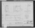 | 5,560 × 4,478 (23.75 MB) | Fæ (talk | contribs) | GWToolset: Creating mediafile for Fæ. HABS 05 July 2014 (401:500) |
You cannot overwrite this file.
File usage on Commons
The following page uses this file: