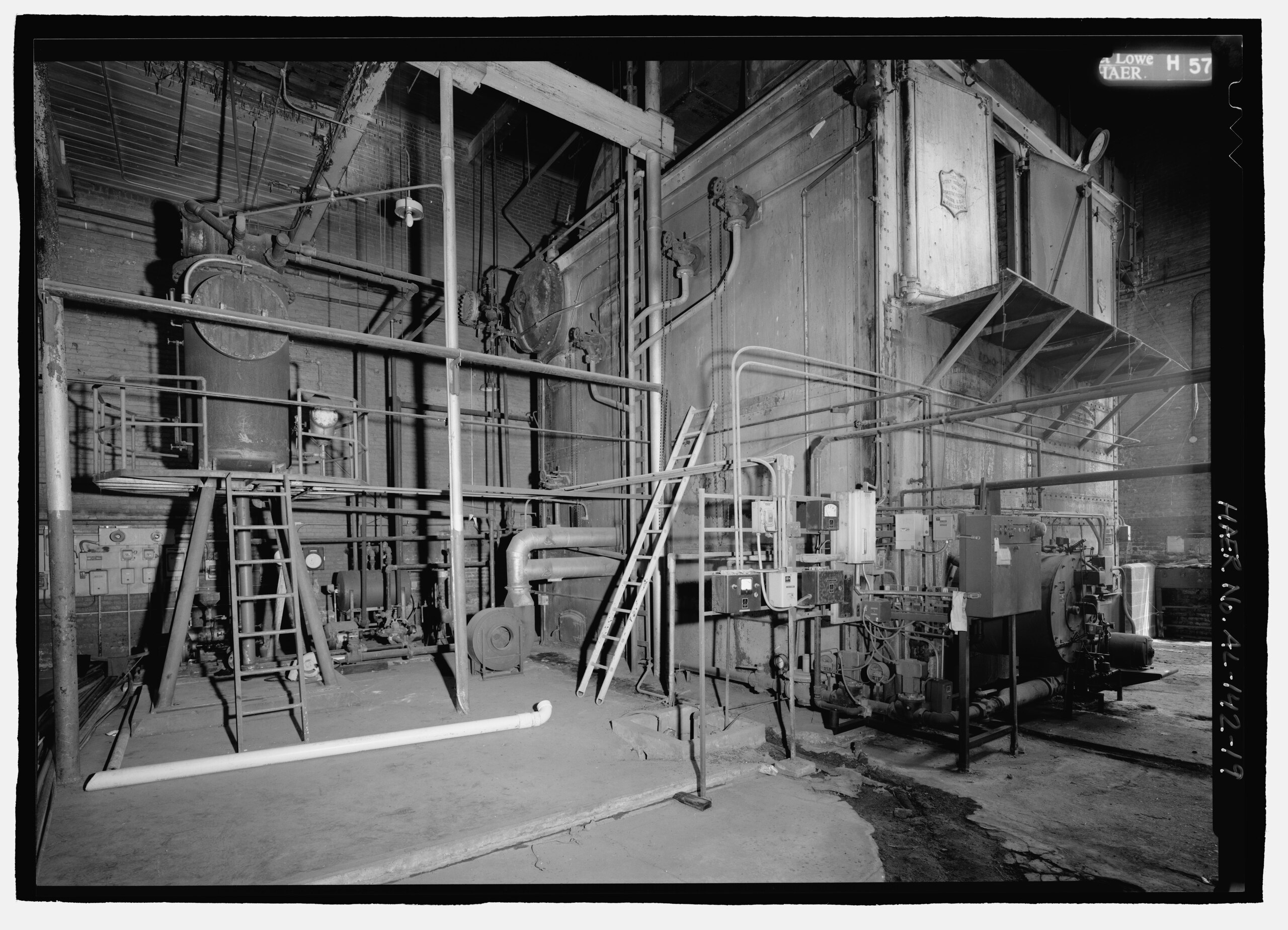
File:Interior of boiler room at Lowe Mill. Builers's plates on the boiler read The Lowe Manufacturing Co. Made by Hedges-Walsh-Weidner, Chattanooga, Tenn. USA and (at top) The Casey-Hedges HAER AL-142-19.tif

Size of this JPG preview of this TIF file: 800 × 577 pixels. Other resolutions: 320 × 231 pixels | 640 × 462 pixels | 1,024 × 739 pixels | 1,280 × 924 pixels | 2,560 × 1,848 pixels | 5,138 × 3,708 pixels.
Original file (5,138 × 3,708 pixels, file size: 18.17 MB, MIME type: image/tiff)
Captions
Captions
Add a one-line explanation of what this file represents
Summary edit
| Photographer |
Lowe, Jet, creator |
|||
| Title |
Interior of boiler room at Lowe Mill. Builers's plates on the boiler read The Lowe Manufacturing Co. Made by Hedges-Walsh-Weidner, Chattanooga, Tenn. USA and (at top) The Casey-Hedges Co. Chattanooga, Tenn. USA - Builders. The tank at left may be an expansion or circulating tank. Its plate reads, Patent 1785983 - The Worthingon Company. - Lowe Mill, Eighth Avenue, Southwest, Huntsville, Madison County, AL |
|||
| Depicted place | Alabama; Madison County; Huntsville | |||
| Date | 1997 | |||
| Dimensions | 5 x 7 in. | |||
| Current location |
Library of Congress Prints and Photographs Division Washington, D.C. 20540 USA http://hdl.loc.gov/loc.pnp/pp.print |
|||
| Accession number |
HAER AL-142-19 |
|||
| Credit line |
|
|||
| Source | https://www.loc.gov/pictures/item/al1233.photos.193088p | |||
| Permission (Reusing this file) |
|

| Camera location | | View this and other nearby images on: OpenStreetMap |
|---|
File history
Click on a date/time to view the file as it appeared at that time.
| Date/Time | Thumbnail | Dimensions | User | Comment | |
|---|---|---|---|---|---|
| current | 09:45, 1 July 2014 |  | 5,138 × 3,708 (18.17 MB) | Fæ (talk | contribs) | GWToolset: Creating mediafile for Fæ. HABS batch upload 29 June 2014 (101:150) |
You cannot overwrite this file.
File usage on Commons
The following page uses this file: