File:King of Prussia Inn, U.S. Route 202 (Upper Merion Township), King of Prussia, Montgomery County, PA HABS PA,46-KING,1- (sheet 6 of 11).tif

Size of this JPG preview of this TIF file: 770 × 599 pixels. Other resolutions: 308 × 240 pixels | 617 × 480 pixels | 987 × 768 pixels | 1,280 × 996 pixels | 2,560 × 1,993 pixels | 10,041 × 7,817 pixels.
Original file (10,041 × 7,817 pixels, file size: 294 KB, MIME type: image/tiff)
Captions
Captions
Add a one-line explanation of what this file represents
Summary edit
| HABS PA,46-KING,1- (sheet 6 of 11) - King of Prussia Inn, U.S. Route 202 (Upper Merion Township), King of Prussia, Montgomery County, PA | ||||
|---|---|---|---|---|
| Title |
HABS PA,46-KING,1- (sheet 6 of 11) - King of Prussia Inn, U.S. Route 202 (Upper Merion Township), King of Prussia, Montgomery County, PA |
|||
| Depicted place | Pennsylvania; Montgomery County; King of Prussia | |||
| Date | Documentation compiled after 1933 | |||
| Dimensions | 19 x 24 in. (B size) | |||
| Current location |
Library of Congress Prints and Photographs Division Washington, D.C. 20540 USA http://hdl.loc.gov/loc.pnp/pp.print |
|||
| Accession number |
HABS PA,46-KING,1- (sheet 6 of 11) |
|||
| Credit line |
|
|||
| Notes |
|
|||
| Source | https://www.loc.gov/pictures/item/pa0627.sheet.00011a | |||
| Permission (Reusing this file) |
|
|||

| Object location | | View this and other nearby images on: OpenStreetMap |
|---|
File history
Click on a date/time to view the file as it appeared at that time.
| Date/Time | Thumbnail | Dimensions | User | Comment | |
|---|---|---|---|---|---|
| current | 22:52, 2 August 2014 | 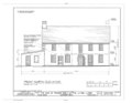 | 10,041 × 7,817 (294 KB) | Fæ (talk | contribs) | GWToolset: Creating mediafile for Fæ. HABS 2014-08-01 2601-2900 missing |
You cannot overwrite this file.
File usage on Commons
The following page uses this file: