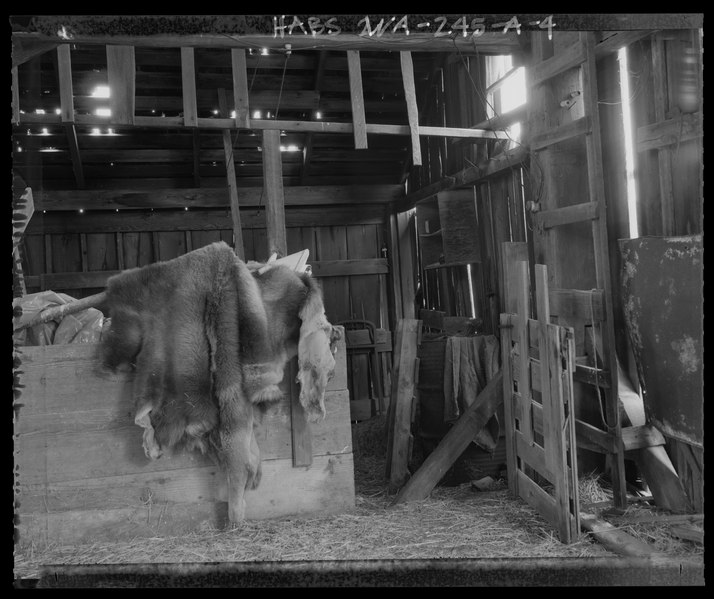
File:LEAN-TO INTERIOR, LOOKING EAST. Image shows- ladder attached to south faand-231;ade, gate separating hay storage from animal pens, and east wall construction.; - Boyer Farm, Barn, 711 HABS WA-245-A-4.tif
Size of this JPG preview of this TIF file: 714 × 600 pixels. Other resolutions: 286 × 240 pixels | 572 × 480 pixels | 915 × 768 pixels | 1,219 × 1,024 pixels | 2,439 × 2,048 pixels | 4,968 × 4,172 pixels.
Original file (4,968 × 4,172 pixels, file size: 39.56 MB, MIME type: image/tiff)
Captions
Captions
Add a one-line explanation of what this file represents
Summary edit
| LEAN-TO INTERIOR, LOOKING EAST. Image shows- ladder attached to south faand-231;ade, gate separating hay storage from animal pens, and east wall construction.; - Boyer Farm, Barn, 711 South Fort Casey Road, Coupeville, Island County, WA | ||||
|---|---|---|---|---|
| Photographer |
Kidd, Anne E., creator |
|||
| Title |
LEAN-TO INTERIOR, LOOKING EAST. Image shows- ladder attached to south faand-231;ade, gate separating hay storage from animal pens, and east wall construction.; - Boyer Farm, Barn, 711 South Fort Casey Road, Coupeville, Island County, WA |
|||
| Depicted place | Washington; Island County; Coupeville | |||
| Date | 2006 | |||
| Dimensions | 4 x 5 in. | |||
| Current location |
Library of Congress Prints and Photographs Division Washington, D.C. 20540 USA http://hdl.loc.gov/loc.pnp/pp.print |
|||
| Accession number |
HABS WA-245-A-4 |
|||
| Credit line |
|
|||
| Notes |
|
|||
| Source | https://www.loc.gov/pictures/item/wa0767.photos.576439p | |||
| Permission (Reusing this file) |
|
|||

File history
Click on a date/time to view the file as it appeared at that time.
| Date/Time | Thumbnail | Dimensions | User | Comment | |
|---|---|---|---|---|---|
| current | 23:46, 4 August 2014 |  | 4,968 × 4,172 (39.56 MB) | Fæ (talk | contribs) | GWToolset: Creating mediafile for Fæ. HABS 2014-08-04 (3601:3800) Penultimate Tranche! |
You cannot overwrite this file.
File usage on Commons
The following page uses this file: