File:Map of Montreal - shewing proposed method of connecting the city, harbor and Grand Trunk Railway (IA McGillLibrary-rbsc proposed-method-connection G3454 M65 1860 L6-16993).pdf

Size of this JPG preview of this PDF file: 800 × 505 pixels. Other resolutions: 320 × 202 pixels | 640 × 404 pixels | 1,024 × 646 pixels | 1,280 × 807 pixels | 2,560 × 1,615 pixels | 5,400 × 3,406 pixels.
Original file (5,400 × 3,406 pixels, file size: 19.15 MB, MIME type: application/pdf)
Captions
Captions
Add a one-line explanation of what this file represents
Summary edit
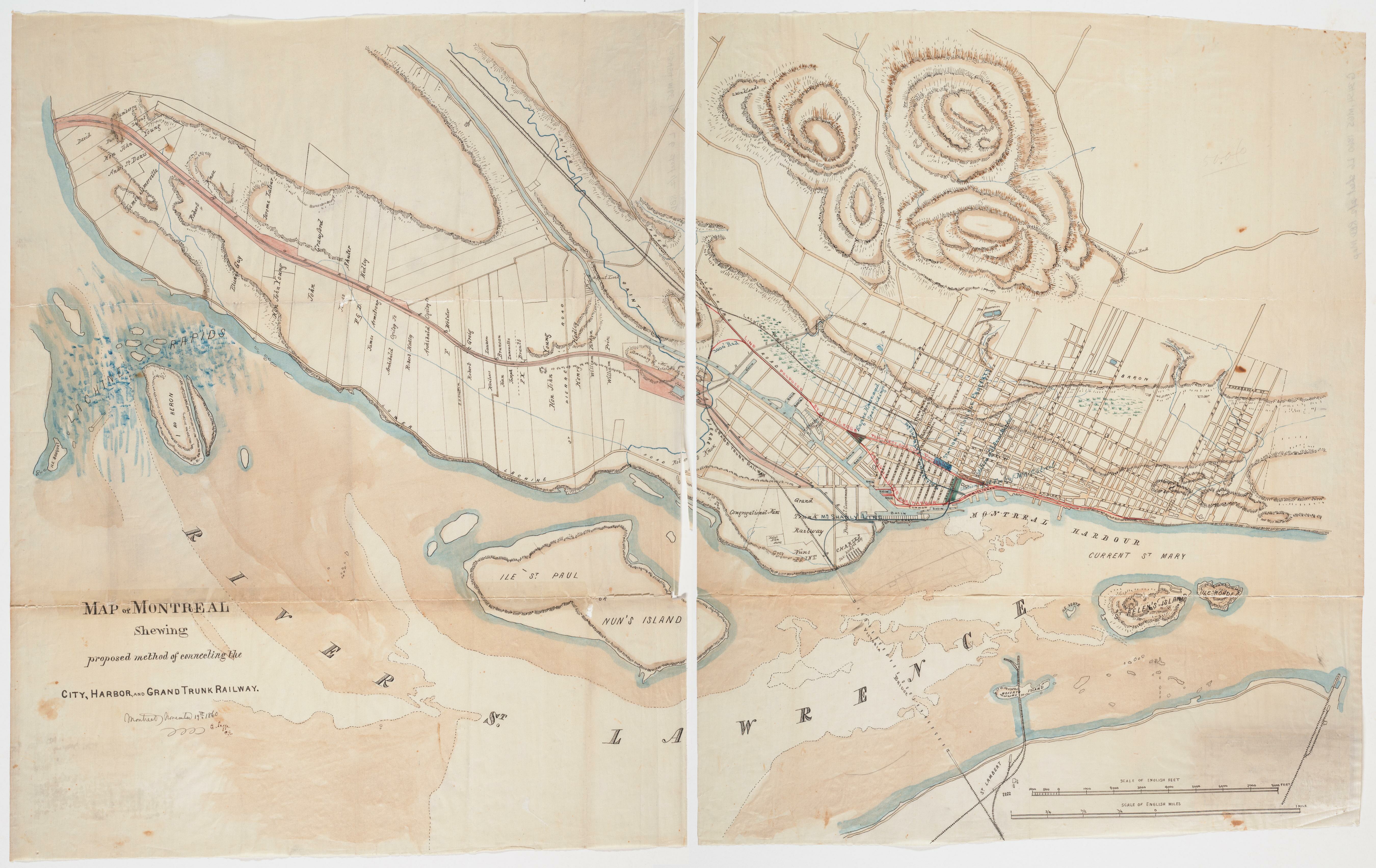
| Map of Montreal : shewing proposed method of connecting the city, harbor and Grand Trunk Railway
( |
|
|---|---|
| Author |
Legge, Charles, 1829-1881 |
| Title |
Map of Montreal : shewing proposed method of connecting the city, harbor and Grand Trunk Railway |
| Publisher |
1860. |
| Description |
Subjects: Grand Trunk Railway Company of Canada -- History.; Railroads -- Québec (Province) -- Montréal -- Maps.; Montréal (Québec) -- Maps.; McGill University Library Digitized Title; Montreal Maps Project; Grand Trunk Railway Company of Canada; Railroads |
| Language | English |
| Publication date | 1860 |
| Current location |
IA Collections: mcgilluniversity; mcgilluniversityrarebooks; toronto |
| Accession number |
McGillLibrary-rbsc_proposed-method-connection_G3454_M65_1860_L6-16993 |
| Source |
|
Licensing edit
|
This work is in the public domain in its country of origin and other countries and areas where the copyright term is the author's life plus 100 years or fewer. This work is in the public domain in the United States because it was published (or registered with the U.S. Copyright Office) before January 1, 1929. | |
| This file has been identified as being free of known restrictions under copyright law, including all related and neighboring rights. | |
File history
Click on a date/time to view the file as it appeared at that time.
| Date/Time | Thumbnail | Dimensions | User | Comment | |
|---|---|---|---|---|---|
| current | 18:52, 1 January 2021 |  | 5,400 × 3,406 (19.15 MB) | Fæ (talk | contribs) | IA Query "subject:maps date:[1000 TO 1869] " McGillLibrary-rbsc_proposed-method-connection_G3454_M65_1860_L6-16993 Category:Old maps (COM:IA books#query) (1860 #359) |
You cannot overwrite this file.
File usage on Commons
The following page uses this file: