File:Martinsloch 077k.jpg

Size of this preview: 800 × 595 pixels. Other resolutions: 320 × 238 pixels | 640 × 476 pixels | 1,024 × 762 pixels | 1,280 × 952 pixels | 2,302 × 1,712 pixels.
Original file (2,302 × 1,712 pixels, file size: 1.23 MB, MIME type: image/jpeg)
Captions
Captions
Add a one-line explanation of what this file represents
Summary edit
| Description |
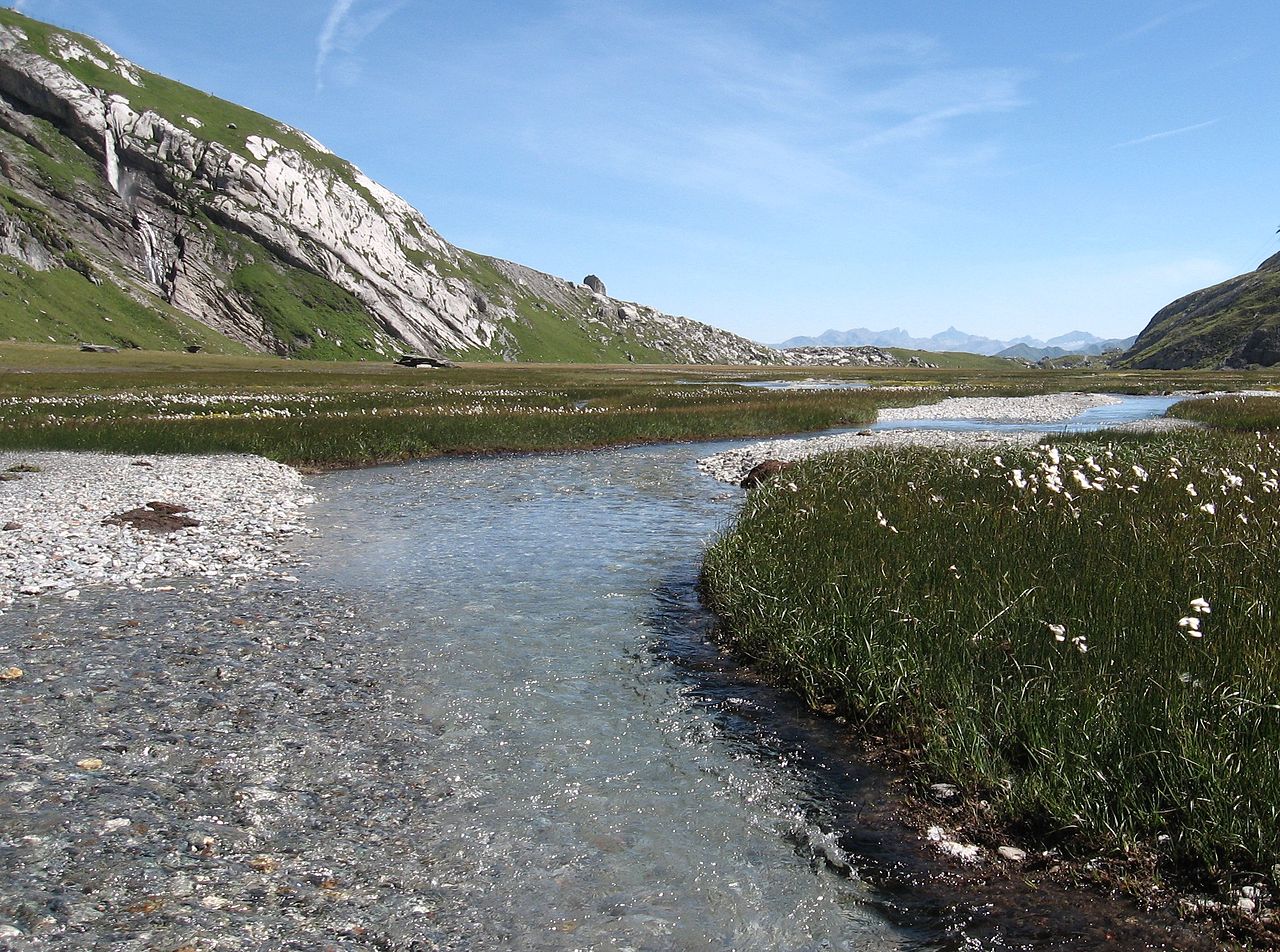
English: Lower plain of Segnas to SE (Camona da Segnas visible at the far end): Crystal clear water is later joined by the waterfall from the left, carrying glacier water from Upper Plain. Area of Glarus Thrust.
Deutsch: Unterer Segnasboden in Richtung Südosten zur Segnashütte; das kristallklare Wasser der umliegenden Quellen wird vom Wasserfall vom oberen Segnasboden mit der Gletschermilch vom Segnasgletscher im vorderen Teil getrübt. Seit 2008 ist der Boden Schutzgebiet und sollte nicht mehr betreten werden. |
| Date | |
| Source | Own work |
| Author | Caumasee |
Licensing edit
I, the copyright holder of this work, hereby publish it under the following licenses:

|
Permission is granted to copy, distribute and/or modify this document under the terms of the GNU Free Documentation License, Version 1.2 or any later version published by the Free Software Foundation; with no Invariant Sections, no Front-Cover Texts, and no Back-Cover Texts. A copy of the license is included in the section entitled GNU Free Documentation License. |
This file is licensed under the Creative Commons Attribution 3.0 Unported license.
- You are free:
- to share – to copy, distribute and transmit the work
- to remix – to adapt the work
- Under the following conditions:
- attribution – You must give appropriate credit, provide a link to the license, and indicate if changes were made. You may do so in any reasonable manner, but not in any way that suggests the licensor endorses you or your use.
You may select the license of your choice.
| Annotations | This image is annotated: View the annotations at Commons |
File history
Click on a date/time to view the file as it appeared at that time.
| Date/Time | Thumbnail | Dimensions | User | Comment | |
|---|---|---|---|---|---|
| current | 05:22, 11 April 2011 | | 2,302 × 1,712 (1.23 MB) | Caumasee (talk | contribs) | {{Information |Description ={{en|1=Lower plain of Segnas to SE (Camona da Segnas visible at the far end): Crystal clear water is later joined by the waterfall from the left, carrying glacier water from Upper Plain. Area of Glarus Thrust.}} {{de|1=Unter |
You cannot overwrite this file.
File usage on Commons
There are no pages that use this file.
File usage on other wikis
The following other wikis use this file:
- Usage on de.wikipedia.org