File:Mount Wrangell topo.jpg

Size of this preview: 742 × 600 pixels. Other resolutions: 297 × 240 pixels | 594 × 480 pixels | 950 × 768 pixels | 1,267 × 1,024 pixels | 2,533 × 2,048 pixels | 5,897 × 4,768 pixels.
Original file (5,897 × 4,768 pixels, file size: 8.72 MB, MIME type: image/jpeg)
Captions
Captions
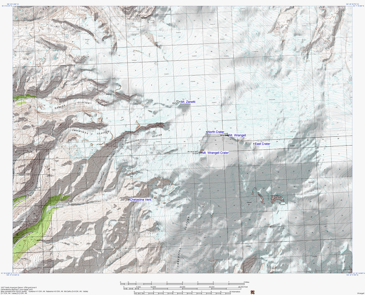
Topographic map of Mount Wrangell volcano, Alska, USA
Summary edit
| Description |
English: Topographic map of Mount Wrangell volcano, Alska, USA
Français : Carte topographique du volcan du mont Wrangell, Alaska, États-Unis |
| Date | |
| Source | http://www.avo.alaska.edu/images/dbimages/1121192360__17.jpg |
| Author | U.S. Geological Survey |
Licensing edit
This image is in the public domain in the United States because it only contains materials that originally came from the United States Geological Survey, an agency of the United States Department of the Interior. For more information, see the official USGS copyright policy.
|
File history
Click on a date/time to view the file as it appeared at that time.
| Date/Time | Thumbnail | Dimensions | User | Comment | |
|---|---|---|---|---|---|
| current | 01:43, 19 February 2013 | | 5,897 × 4,768 (8.72 MB) | Acroterion (talk | contribs) | {{Information |Description ={{en|1=Topographic map of Mount Wrangell volcano, Alska, USA}} |Source =http://www.avo.alaska.edu/images/dbimages/1121192360__17.jpg |Author =U.S. Geological Survey |Date =2005 |Permission ={... |
You cannot overwrite this file.
File usage on Commons
There are no pages that use this file.
File usage on other wikis
The following other wikis use this file:
- Usage on en.wikipedia.org
- Usage on es.wikipedia.org