File:Niger-Kongo-Karte.png
Size of this preview: 635 × 599 pixels. Other resolutions: 254 × 240 pixels | 509 × 480 pixels | 814 × 768 pixels | 1,207 × 1,139 pixels.
Original file (1,207 × 1,139 pixels, file size: 138 KB, MIME type: image/png)
Captions
Captions
Add a one-line explanation of what this file represents
Summary
edit
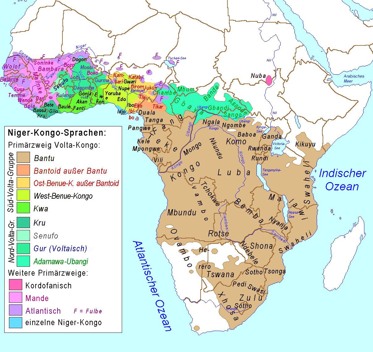
| Description | Map of the Niger-Congo-languages und Khoi-San-languages in Afrika / Karte der Niger-Kongo-Sprachen und Khoisan-Sprachen in Afrika |
| Date | |
| Source | Relaunch (especially larger letters) of de:Image:Karte_der_Niger-Kongo-Sprachen.PNG, primarily drawn by de:Benutzer:Et_Mikkel |
| Author | Ulamm |
| Other versions | Image:Niger-Congo_map.png (in English) |
Licensing
edit
| I, the copyright holder of this work, release this work into the public domain. This applies worldwide. In some countries this may not be legally possible; if so: I grant anyone the right to use this work for any purpose, without any conditions, unless such conditions are required by law. |
File history
Click on a date/time to view the file as it appeared at that time.
| Date/Time | Thumbnail | Dimensions | User | Comment | |
|---|---|---|---|---|---|
| current | 20:57, 15 March 2018 | | 1,207 × 1,139 (138 KB) | Maphobbyist (talk | contribs) | South Sudan border |
| 00:56, 4 July 2015 |  | 1,207 × 1,139 (137 KB) | Kwamikagami (talk | contribs) | rm. Khoisan | |
| 20:29, 28 October 2007 |  | 1,207 × 1,139 (76 KB) | Ulamm (talk | contribs) | ||
| 08:52, 26 October 2007 |  | 1,207 × 1,139 (77 KB) | Ulamm (talk | contribs) | == Summary == {{Information |Description=Map of the Niger-Congo-languages und Khoi-San-languages in Afrika / Karte der Niger-Kongo-Sprachen und Khoisan-Sprachen in Afrika |Source=Relaunch (especially larger letters) of [[:de:Image:Karte_der_Niger-Kongo-Sp |
You cannot overwrite this file.
File usage on Commons
The following page uses this file:
File usage on other wikis
The following other wikis use this file:
- Usage on bg.wikipedia.org
- Usage on de.wikipedia.org
- Usage on eo.wikipedia.org
- Usage on frr.wikipedia.org
- Usage on ilo.wikipedia.org
- Usage on lv.wikipedia.org
- Usage on ps.wikipedia.org
- Usage on pt.wikipedia.org