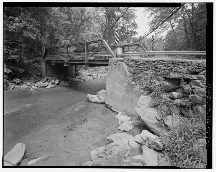
File:OBLIQUE VIEW OF WEST TRUSS AND WEST SIDE OF SOUTH ABUTMENT; VIEW TO NORTHEAST. - Mitchell's Mill Bridge, Spanning Winter's Run on Carrs Mill Road, west of Bel Air, Bel Air, HAER MD,13-BELAR.V,5-6.tif
Size of this JPG preview of this TIF file: 752 × 600 pixels. Other resolutions: 301 × 240 pixels | 602 × 480 pixels | 963 × 768 pixels | 1,280 × 1,021 pixels | 2,560 × 2,042 pixels | 5,000 × 3,989 pixels.
Original file (5,000 × 3,989 pixels, file size: 19.02 MB, MIME type: image/tiff)
Captions
Captions
Add a one-line explanation of what this file represents
Summary
edit| OBLIQUE VIEW OF WEST TRUSS AND WEST SIDE OF SOUTH ABUTMENT; VIEW TO NORTHEAST. - Mitchell's Mill Bridge, Spanning Winter's Run on Carrs Mill Road, west of Bel Air, Bel Air, Harford County, MD | ||||
|---|---|---|---|---|
| Title |
OBLIQUE VIEW OF WEST TRUSS AND WEST SIDE OF SOUTH ABUTMENT; VIEW TO NORTHEAST. - Mitchell's Mill Bridge, Spanning Winter's Run on Carrs Mill Road, west of Bel Air, Bel Air, Harford County, MD |
|||
| Depicted place | Maryland; Harford County; Bel Air | |||
| Date | Documentation compiled after 1968 | |||
| Dimensions | 4 x 5 in. | |||
| Current location |
Library of Congress Prints and Photographs Division Washington, D.C. 20540 USA http://hdl.loc.gov/loc.pnp/pp.print |
|||
| Accession number |
HAER MD,13-BELAR.V,5-6 |
|||
| Credit line |
|
|||
| Notes |
|
|||
| Source | https://www.loc.gov/pictures/item/md1229.photos.185729p | |||
| Permission (Reusing this file) |
|
|||

File history
Click on a date/time to view the file as it appeared at that time.
| Date/Time | Thumbnail | Dimensions | User | Comment | |
|---|---|---|---|---|---|
| current | 18:41, 28 July 2014 |  | 5,000 × 3,989 (19.02 MB) | Fæ (talk | contribs) | GWToolset: Creating mediafile for Fæ. HABS 21 July 2014 (1601:1800) |
You cannot overwrite this file.
File usage on Commons
The following page uses this file: