File:Odessa province location map.svg

Size of this PNG preview of this SVG file: 464 × 599 pixels. Other resolutions: 186 × 240 pixels | 372 × 480 pixels | 595 × 768 pixels | 793 × 1,024 pixels | 1,586 × 2,048 pixels | 533 × 688 pixels.
Original file (SVG file, nominally 533 × 688 pixels, file size: 336 KB)
Captions
Captions
Add a one-line explanation of what this file represents
Summary edit
| Description |
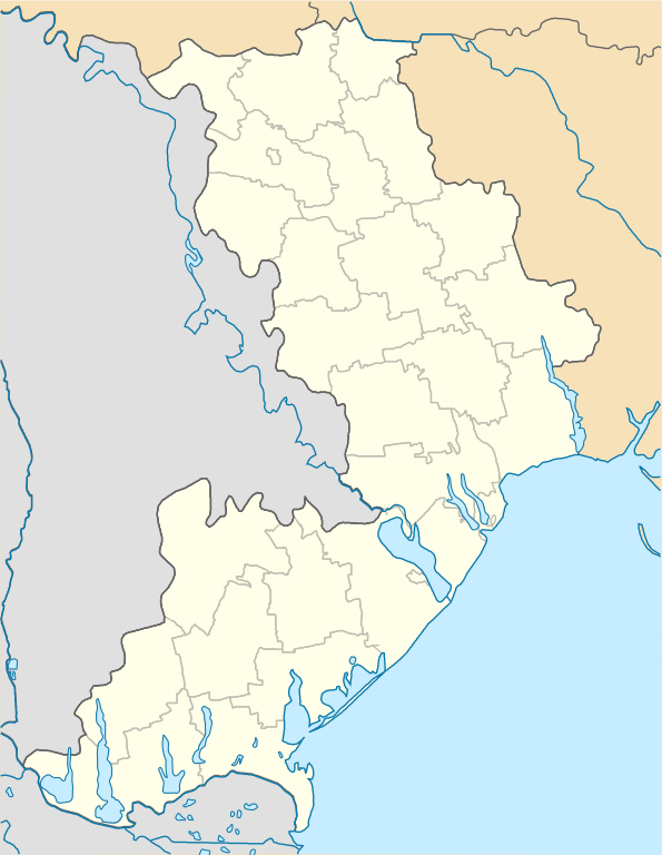
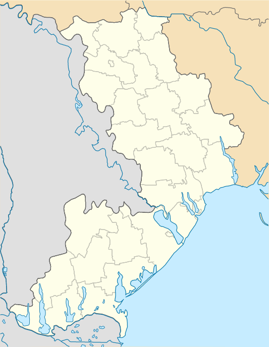
English: Location map of Odesa province, Ukraine
Русский: Позиционная карта Одесской области, Украина
Українська: Карта Одеської області, Україна |
| Date | |
| Source | Own work |
| Author | Urutseg |
| Other versions |
 |
Licensing edit
| I, the copyright holder of this work, release this work into the public domain. This applies worldwide. In some countries this may not be legally possible; if so: I grant anyone the right to use this work for any purpose, without any conditions, unless such conditions are required by law. |
File history
Click on a date/time to view the file as it appeared at that time.
| Date/Time | Thumbnail | Dimensions | User | Comment | |
|---|---|---|---|---|---|
| current | 12:22, 17 April 2020 | | 533 × 688 (336 KB) | Shiro D. Neko (talk | contribs) | lakes |
| 08:41, 29 June 2014 |  | 533 × 688 (313 KB) | קרלוס הגדול (talk | contribs) | lighter borders between provinces | |
| 18:15, 4 December 2010 |  | 533 × 688 (313 KB) | Urutseg (talk | contribs) | == Summary == {{Information |Description={{en|1=Location map of Odessa province, Ukraine}} {{ru|1=Позиционная карта Одесской области, Украина}} |Source={{own}} |Author=Urutseg |Date=2010-12-04 |Permis |
You cannot overwrite this file.
File usage on Commons
The following page uses this file:
File usage on other wikis
The following other wikis use this file:
- Usage on ar.wikipedia.org
- Usage on azb.wikipedia.org
- Usage on de.wikipedia.org
- Usage on es.wikipedia.org
- Usage on fa.wikipedia.org
- Usage on he.wikipedia.org
- Usage on hy.wikipedia.org
- Խաջիբեյի լիման
- Կաղապար:Բնակավայր Ուկրաինա
- Կաղապար:Տեղորոշման քարտեզ Ուկրաինա Օդեսայի մարզ
- Կաղապար:Բնակավայր Ուկրաինա/doc
- Անանիև
- Արցիզ
- Նովայա Իվանովկա (գյուղ, Արցիզի շրջան)
- Բալտա (քաղաք, Ուկրաինա)
- Բելգորոդ-Դնեստրովսկի
- Կազացկոե (գյուղ, Բելգորոդ-Դնեստրովսկիի շրջան)
- Մոլոգա (գյուղ, Բելգորոդ-Դնեստրովսկիի շրջան)
- Սադովոե (գյուղ, Բելգորոդ-Դնեստրովսկիի շրջան)
- Բելյաևկա (քաղաք, Ուկրաինա)
- Բերեզան (քաղաքատիպ ավան, Ուկրաինա)
- Իլինկա (գյուղ, Բելյավկայի շրջան)
- Տեպլոդար
- Բերեզովկա (քաղաք, Ուկրաինա)
- Զավոդովկա (գյուղ, Բերեզովկայի շրջան)
- Բոլգրադ (քաղաք, Ուկրաինա)
- Ժովտնևոե (գյուղ, Բոլգրադի շրջան)
- Կալչևա
- Վասիլևկա (գյուղ, Բոլգրադի շրջան)
- Վինոգրադնոե (գյուղ, Բոլգրադի շրջան)
- Վինոգրադովկա (գյուղ, Բոլգրադի շրջան)
- Վլադիչեն (գյուղ, Բոլգրադի շրջան)
- Օգորոդնոե (գյուղ, Բոլգրադի շրջան)
- Տատարբունարի
View more global usage of this file.