File:Ontwerp van plattegronden van enige huizen in de nieuwe uitleg van Haarlem, Inventarisnummer NL-HlmNHA 51000423.JPG

Size of this preview: 800 × 569 pixels. Other resolutions: 320 × 227 pixels | 640 × 455 pixels | 1,024 × 728 pixels | 1,280 × 910 pixels | 2,560 × 1,820 pixels | 6,040 × 4,293 pixels.
Original file (6,040 × 4,293 pixels, file size: 7.44 MB, MIME type: image/jpeg)
Captions
Captions
Add a one-line explanation of what this file represents
Summary
edit
| Description |
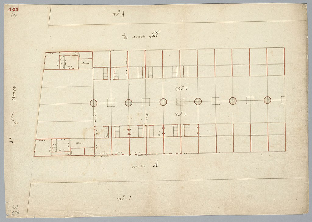
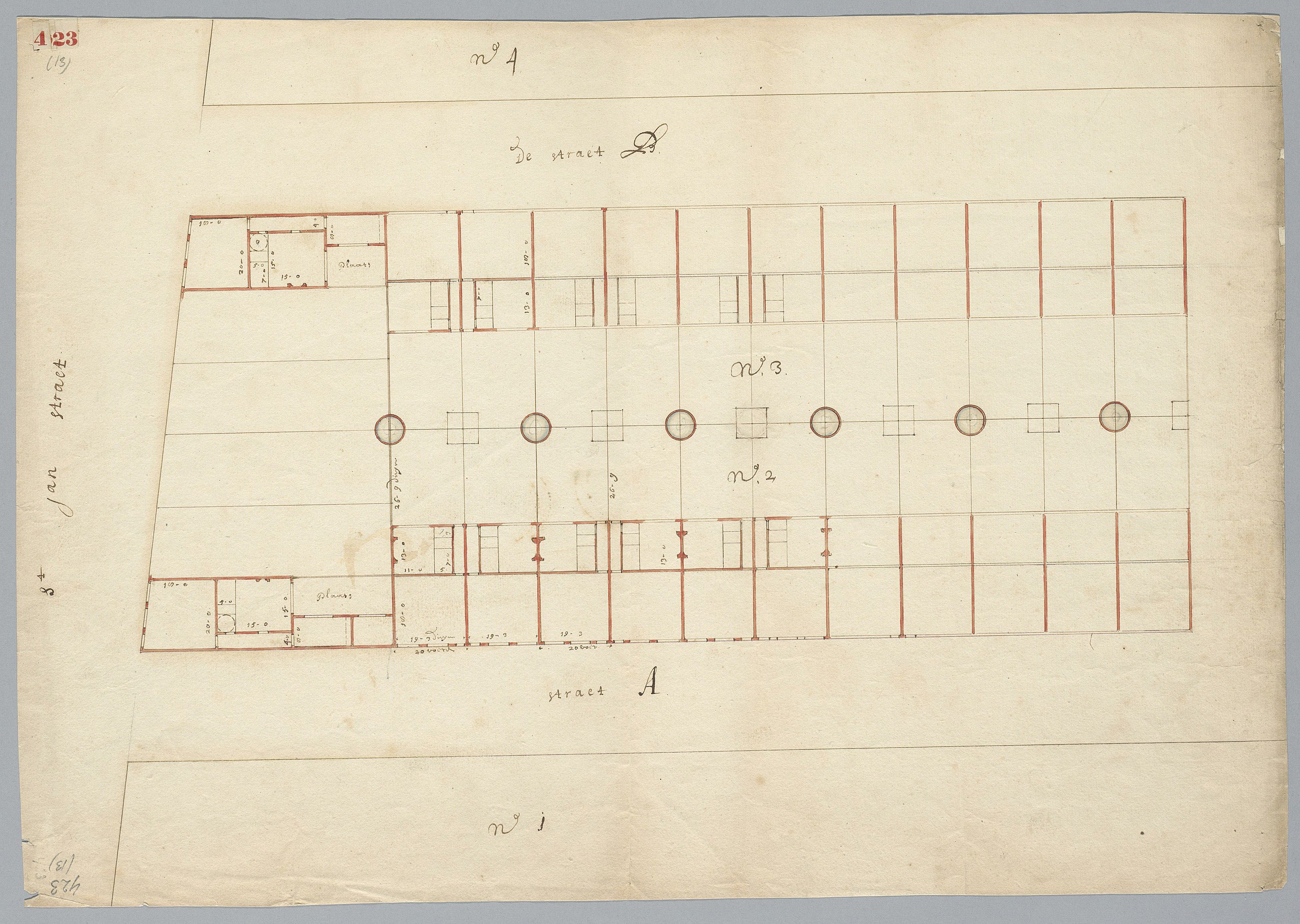
Nederlands: Collectie: Beeldcollectie van de gemeente Haarlem Inventarisnummer: NL-HlmNHA_51000423 Soort: Kaart Beschrijving: Ontwerp van plattegronden van enige huizen in de nieuwe uitleg van Haarlem. Vervaardiger(s): Anoniem Datering: 1640 - 1680 Documenttype: Kaarten en plattegronden Land: Nederland Provincie: Noord-Holland Gemeente: Haarlem Plaatsnaam: Haarlem Auteursrecht: Nee Afmetingen hoogte: 36 Afmetingen breedte: 52 Techniek: Tekening Bij gebruik van deze afbeelding wordt bronvermelding wel zeer op prijs gesteld. |
| Date | between 1640 and 1680 |
| Source | https://noord-hollandsarchief.nl/beelden/beeldbank/detail/F1E6828EFB8E11DF9E4D523BC2E286E2/media/ |
| Author | Anonymous |
Licensing
edit
| This file is made available under the Creative Commons CC0 1.0 Universal Public Domain Dedication. | |
| The person who associated a work with this deed has dedicated the work to the public domain by waiving all of their rights to the work worldwide under copyright law, including all related and neighboring rights, to the extent allowed by law. You can copy, modify, distribute and perform the work, even for commercial purposes, all without asking permission.
|
File history
Click on a date/time to view the file as it appeared at that time.
| Date/Time | Thumbnail | Dimensions | User | Comment | |
|---|---|---|---|---|---|
| current | 17:02, 15 July 2020 | | 6,040 × 4,293 (7.44 MB) | Mr.Nostalgic (talk | contribs) | == {{int:filedesc}} == {{Information |Description={{nl|<br>'''Collectie: '''Beeldcollectie van de gemeente Haarlem<br>'''Inventarisnummer: '''NL-HlmNHA_51000423<br>'''Soort: '''Kaart<br>'''Beschrijving: '''Ontwerp van plattegronden van enige huizen in de nieuwe uitleg van Haarlem.<br>'''Vervaardiger(s): '''Anoniem<br>'''Datering: '''1640 - 1680<br>'''Documenttype: '''Kaarten en plattegronden<br>'''Land: '''Nederland<br>'''Provincie: '''Noord-Holland<br>'''Gemeente: '''Haarlem<br>'''Plaatsnaam... |
You cannot overwrite this file.
File usage on Commons
There are no pages that use this file.