File:Plan of the Manor Farm and Saw and Grist Mills at St. Thomas Riviere du Sud (IA McGillLibrary-rbsc map G3452-1853-P53-19257).pdf
Size of this JPG preview of this PDF file: 560 × 599 pixels. Other resolutions: 224 × 240 pixels | 449 × 480 pixels | 718 × 768 pixels | 957 × 1,024 pixels | 1,914 × 2,048 pixels | 3,227 × 3,452 pixels.
Original file (3,227 × 3,452 pixels, file size: 42.44 MB, MIME type: application/pdf)
Captions
Captions
Add a one-line explanation of what this file represents
Summary edit
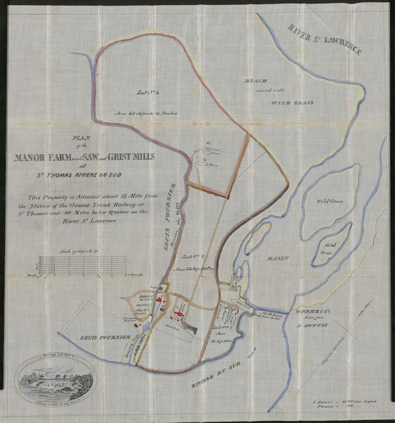
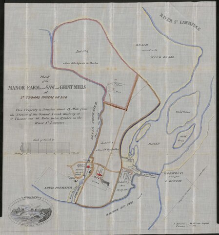
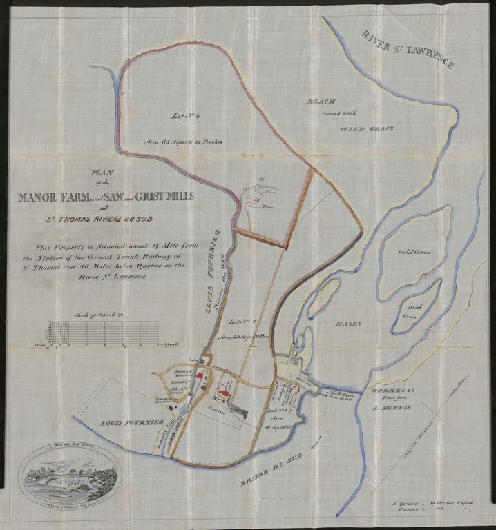
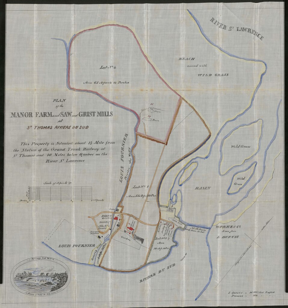
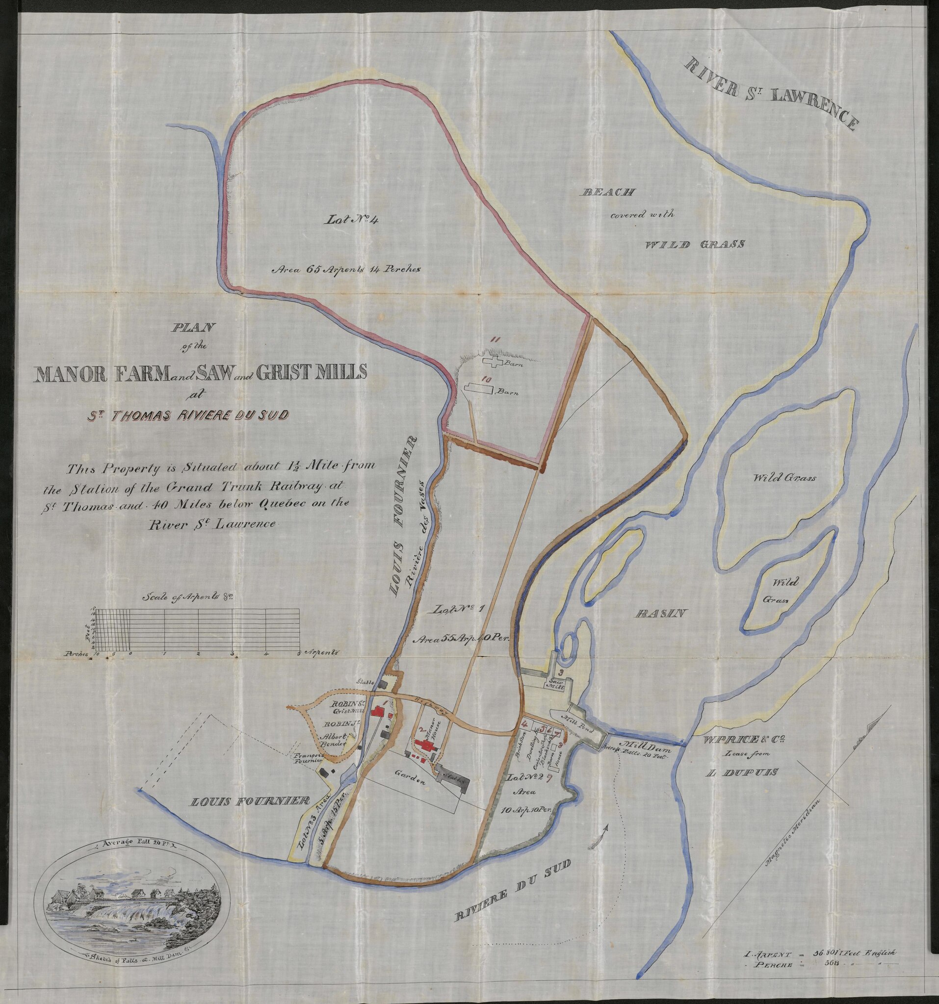
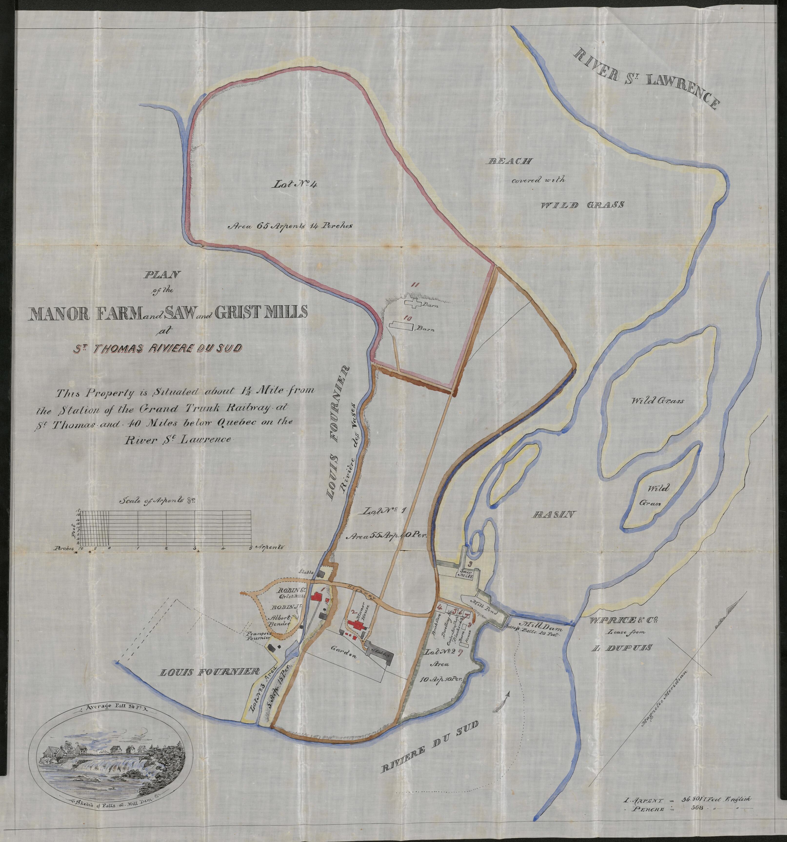
| Plan of the Manor Farm and Saw and Grist Mills at St. Thomas Riviere du Sud
( |
|
|---|---|
| Author |
|
| Title |
Plan of the Manor Farm and Saw and Grist Mills at St. Thomas Riviere du Sud |
| Publisher |
[Place of publication not identified] : [publisher not identified] |
| Description |
Subjects: Grand Trunk Railway Company of Canada.; Real property -- Québec (Province) -- Maps.; Real property -- Québec (Province) -- Montmagny -- Maps.; Landowners -- Québec (Province) -- Maps.; Landowners -- Québec (Province) -- Montmagny -- Maps.; Montmagny (Québec : County) -- Maps.; Québec (Province) -- Maps.; McGill University Library Digitized Title; Large Scale Digitization Initiative Batch 19; Grand Trunk Railway Company of Canada; Real property -- Québec (Province) -- Maps; Real property -- Québec (Province) -- Montmagny -- Maps; Landowners -- Québec (Province) -- Maps; Landowners -- Québec (Province) -- Montmagny -- Maps; Landowners; Real property; Montmagny (Québec : County) -- Maps; Québec (Province) -- Maps; Québec; Québec -- Montmagny; Québec -- Montmagny (County) |
| Language | English |
| Publication date | 1853 |
| Current location |
IA Collections: mcgilluniversity; mcgilluniversityrarebooks; toronto |
| Accession number |
McGillLibrary-rbsc_map_G3452-1853-P53-19257 |
| Source |
|
Licensing edit
|
This work is in the public domain in its country of origin and other countries and areas where the copyright term is the author's life plus 100 years or fewer. This work is in the public domain in the United States because it was published (or registered with the U.S. Copyright Office) before January 1, 1929. | |
| This file has been identified as being free of known restrictions under copyright law, including all related and neighboring rights. | |
File history
Click on a date/time to view the file as it appeared at that time.
| Date/Time | Thumbnail | Dimensions | User | Comment | |
|---|---|---|---|---|---|
| current | 16:36, 1 January 2021 |  | 3,227 × 3,452 (42.44 MB) | Fæ (talk | contribs) | IA Query "subject:maps date:[1000 TO 1869] " McGillLibrary-rbsc_map_G3452-1853-P53-19257 Category:Old maps (COM:IA books#query) (1853 #228) |
You cannot overwrite this file.
File usage on Commons
The following page uses this file: