File:Plan of the city and fortifications of algiers - 1816.jpg

Size of this preview: 746 × 600 pixels. Other resolutions: 299 × 240 pixels | 597 × 480 pixels | 955 × 768 pixels | 1,274 × 1,024 pixels | 1,500 × 1,206 pixels.
Original file (1,500 × 1,206 pixels, file size: 172 KB, MIME type: image/jpeg)
Captions
Captions
Add a one-line explanation of what this file represents
Summary edit
| Description |
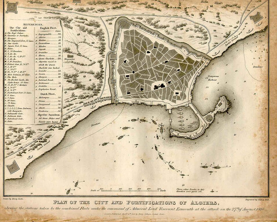
English: Plan of the city and fortifications of Algiers, showing the stations taken by the combined Fleets under the command of Admiral Lord Viscount Exmouth at the attack on the 27th of August 1816. |
||||||||||||||||
| Date | |||||||||||||||||
| Source | http://encyclopedie-afn.org/index.php/Alger_-_Exmouth_-Carte | ||||||||||||||||
| Author |
|
||||||||||||||||
Licensing edit
|
This work is in the public domain in its country of origin and other countries and areas where the copyright term is the author's life plus 100 years or fewer. | |
| This file has been identified as being free of known restrictions under copyright law, including all related and neighboring rights. | |
File history
Click on a date/time to view the file as it appeared at that time.
| Date/Time | Thumbnail | Dimensions | User | Comment | |
|---|---|---|---|---|---|
| current | 05:49, 6 September 2010 | | 1,500 × 1,206 (172 KB) | Madame Grinderche (talk | contribs) | {{Information |Description={{en|1=Plan of the city and fortifications of Algiers, showing the stations taken by the combined Fleets under the command of Admiral Lord Viscount Exmouth at the attack on the 27th of August 1816.}} |Source=http://encyclopedie- |
You cannot overwrite this file.
File usage on Commons
The following page uses this file:
File usage on other wikis
The following other wikis use this file:
- Usage on hr.wikipedia.org
- Usage on sh.wikipedia.org