File:ProvinceOfLubiana1941 43.png
Size of this preview: 800 × 552 pixels. Other resolutions: 320 × 221 pixels | 640 × 442 pixels | 1,024 × 707 pixels | 1,280 × 883 pixels | 2,000 × 1,380 pixels.
Original file (2,000 × 1,380 pixels, file size: 706 KB, MIME type: image/png)
Captions
Captions
Add a one-line explanation of what this file represents
Summary edit
| Description |
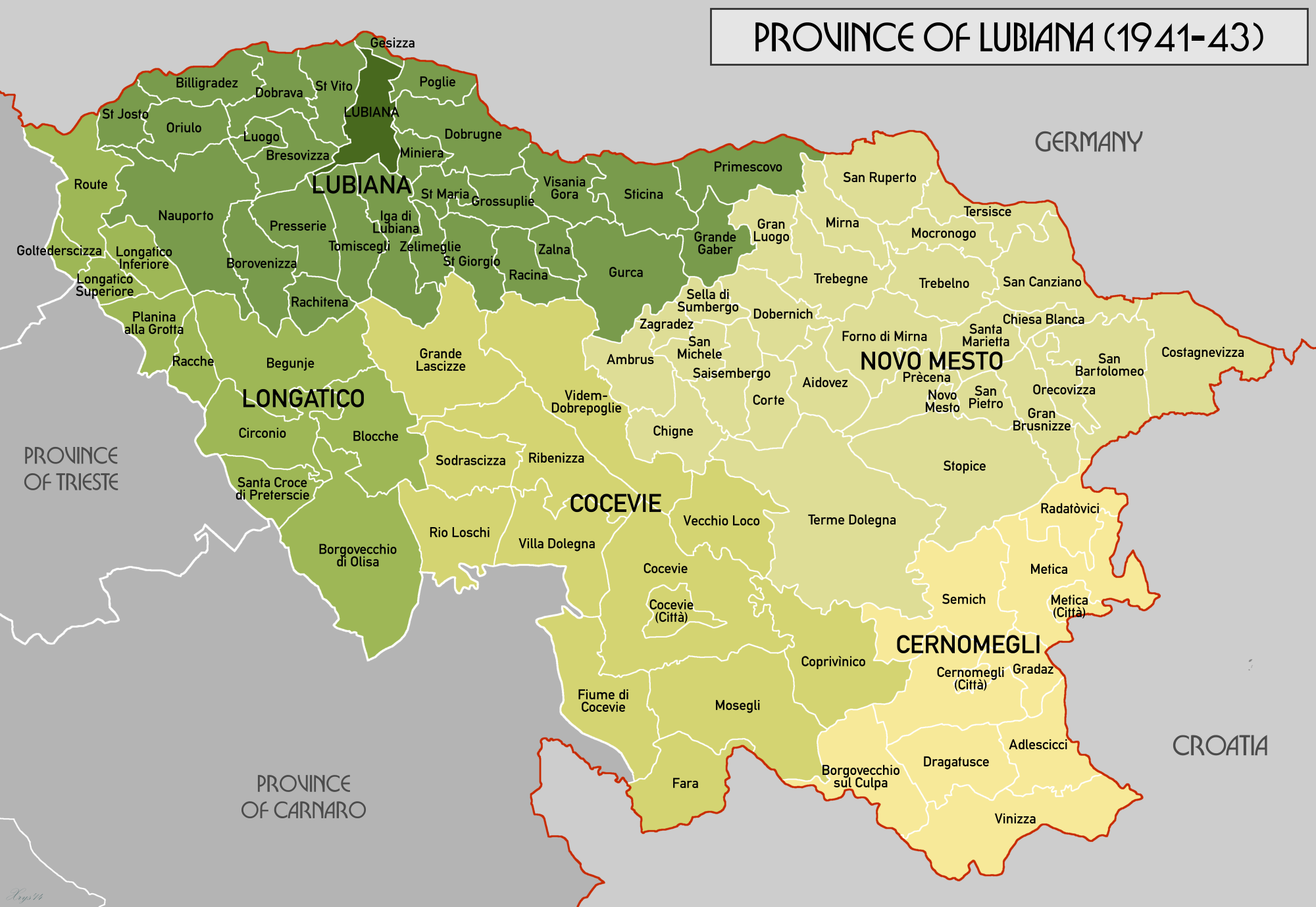
English: Administrative map of the Province of Lubiana (1941-43). Source data from Volkstumskarte von Jugoslawien, Wilfried Krallert (1941). Unit data from " Fascism's European empire: Italian occupation during the Second World War", Davide Rodogno (2006) |
| Date | |
| Source | Own work |
| Author | XrysD |
Licensing edit
I, the copyright holder of this work, hereby publish it under the following license:
This file is licensed under the Creative Commons Attribution-Share Alike 4.0 International license.
- You are free:
- to share – to copy, distribute and transmit the work
- to remix – to adapt the work
- Under the following conditions:
- attribution – You must give appropriate credit, provide a link to the license, and indicate if changes were made. You may do so in any reasonable manner, but not in any way that suggests the licensor endorses you or your use.
- share alike – If you remix, transform, or build upon the material, you must distribute your contributions under the same or compatible license as the original.
File history
Click on a date/time to view the file as it appeared at that time.
| Date/Time | Thumbnail | Dimensions | User | Comment | |
|---|---|---|---|---|---|
| current | 17:21, 27 March 2018 | | 2,000 × 1,380 (706 KB) | XrysD (talk | contribs) | Fixed typos Sebenico-->Miniera, Zlarino-->Dobrugne and Chistegne-->Poglie |
| 19:37, 21 December 2014 |  | 2,000 × 1,380 (706 KB) | XrysD (talk | contribs) | User created page with UploadWizard |
You cannot overwrite this file.
File usage on Commons
The following 2 pages use this file:
File usage on other wikis
The following other wikis use this file:
- Usage on en.wikipedia.org
- Usage on fr.wikipedia.org