File:Rheintal vor der korrektur.jpg
Size of this preview: 641 × 599 pixels. Other resolutions: 257 × 240 pixels | 513 × 480 pixels | 844 × 789 pixels.
Original file (844 × 789 pixels, file size: 650 KB, MIME type: image/jpeg)
Captions
Captions
Add a one-line explanation of what this file represents
Summary edit
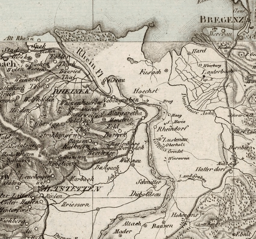
| Description |
Deutsch: Carl Ferdinand Weiland, Karte der Schweiz, Ausschnitt oberes Rheintal |
||||||||||||||||
| Date | |||||||||||||||||
| Source | File:Karte der Schweiz von 1817, 7976026.jpg | ||||||||||||||||
| Author |
|
||||||||||||||||
| Other versions |
 |
||||||||||||||||

Licensing edit
|
This work is in the public domain in its country of origin and other countries and areas where the copyright term is the author's life plus 100 years or fewer. This work is in the public domain in the United States because it was published (or registered with the U.S. Copyright Office) before January 1, 1929. | |
| This file has been identified as being free of known restrictions under copyright law, including all related and neighboring rights. | |
File history
Click on a date/time to view the file as it appeared at that time.
| Date/Time | Thumbnail | Dimensions | User | Comment | |
|---|---|---|---|---|---|
| current | 22:36, 22 May 2020 | | 844 × 789 (650 KB) | Nightflyer (talk | contribs) | {{Information |Description= |Source={{own}} |Date= |Author= Nightflyer |Permission= |other_versions= }} |
You cannot overwrite this file.
File usage on Commons
The following 2 pages use this file:
File usage on other wikis
The following other wikis use this file:
- Usage on de.wikipedia.org