File:Saarland location map.svg

Size of this PNG preview of this SVG file: 658 × 540 pixels. Other resolutions: 293 × 240 pixels | 585 × 480 pixels | 936 × 768 pixels | 1,248 × 1,024 pixels | 2,496 × 2,048 pixels.
Original file (SVG file, nominally 658 × 540 pixels, file size: 45 KB)
Captions
Captions
Add a one-line explanation of what this file represents
Summary edit
| Description |
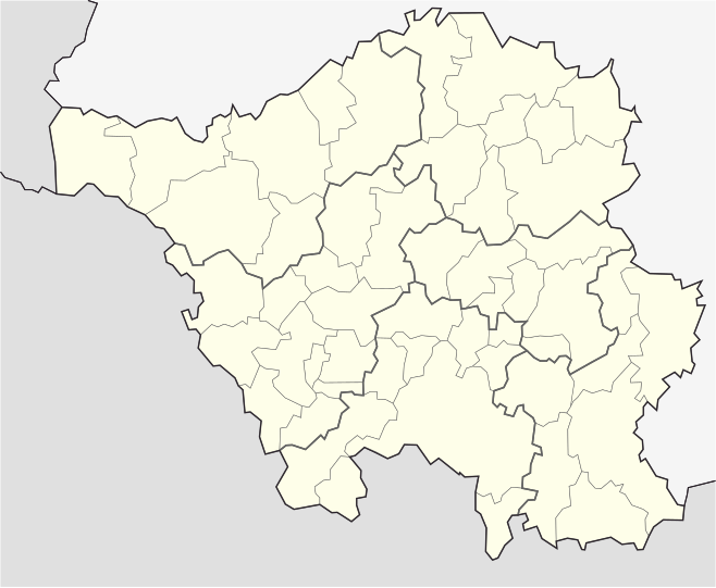
English: Position map of the state of Saarland with the six disticts and fiftytwo municipalities
Geographic limits of the map: * N: 49.65° N * S: 49.09° N * W: 6.3° E * E: 7.405° E Deutsch: Positionskarte vom Bundesland Saarland mit seinen sechs Kreisen und 52 Gemeinden Quadratische Plattkarte. Geographische Begrenzung der Karte: * N: 49.65° N * S: 49.09° N * W: 6.3° E * E: 7.405° E |
| Date | |
| Source | Own work |
| Author | Lantus |
| Other versions |
|


Licensing edit
I, the copyright holder of this work, hereby publish it under the following license:
This file is licensed under the Creative Commons Attribution-Share Alike 3.0 Unported license.
- You are free:
- to share – to copy, distribute and transmit the work
- to remix – to adapt the work
- Under the following conditions:
- attribution – You must give appropriate credit, provide a link to the license, and indicate if changes were made. You may do so in any reasonable manner, but not in any way that suggests the licensor endorses you or your use.
- share alike – If you remix, transform, or build upon the material, you must distribute your contributions under the same or compatible license as the original.
File history
Click on a date/time to view the file as it appeared at that time.
| Date/Time | Thumbnail | Dimensions | User | Comment | |
|---|---|---|---|---|---|
| current | 01:25, 25 July 2008 | | 658 × 540 (45 KB) | Chumwa (talk | contribs) | etwas dezentere Grenzlinien, Rahmen entfernt, Farbanpassung Rheinland-Pfalz (da selbe administrative Ebene wie Saarland) |
| 17:34, 5 July 2008 |  | 826 × 679 (39 KB) | Lantus (talk | contribs) | Position map of the state of Saarland with the six disticts and fitytwo municipalities Equirectangular projection. Geographic limits of the map: * N: 49.65° N * S: 49.09° N * W: 6.3° E * E: 7.405° E Positionskarte vom Bundesland Saarl | |
| 17:18, 5 July 2008 |  | 826 × 679 (39 KB) | Lantus (talk | contribs) | {{Information |Description={{en|1=Position map of the state of Saarland with the six disticts and fitytwo municipalities}} {{de|1=Positionskarte vom Bundesland Saarland mit seinen sechs Kreisen und 52 Gemeinden}} |Source=Eigenes Werk (own work) |Author=[[ |
You cannot overwrite this file.
File usage on Commons
The following 5 pages use this file:
File usage on other wikis
The following other wikis use this file:
- Usage on ba.wikipedia.org
- Usage on cs.wikipedia.org
- Usage on da.wikipedia.org
- Usage on de.wikipedia.org
- Usage on dsb.wikipedia.org
- Usage on es.wikipedia.org
- Usage on gl.wikipedia.org
- Usage on hy.wikipedia.org
- Usage on ro.wikipedia.org
- Usage on ru.wikipedia.org
- Саарбрюккен
- Зарлуи
- Беккинген
- Нонвайлер
- Энсдорф (Саар)
- Перль (Саар)
- Марпинген
- Лебах
- Вадерн
- Зульцбах (Саар)
- Шпизен-Эльферсберг
- Швальбах (Саар)
- Метлах
- Санкт-Вендель
- Толай (община)
- Пютлинген
- Диллинген (Саар)
- Нофельден
- Фридрихсталь (Саар)
- Намборн
- Квиршид
- Релинген-Зирсбург
- Иберхерн
- Зарвеллинген
- Фёльклинген
- Мерхвайлер
- Бус (Саар)
- Хомбург (Саар)
- Санкт-Ингберт
- Валлерфанген
- Нойнкирхен (Саар)
- Лосхайм-ам-Зе
- Отвайлер
- Мерциг
- Киркель
- Вадгассен
- Хойсвайлер
- Клайнблиттерсдорф
- Блискастель
View more global usage of this file.