File:The railway bridge over the St. Lawrence at Montreal (IA McGillLibrary-rbsc railway lawrence G3454M651852C5-16683).pdf

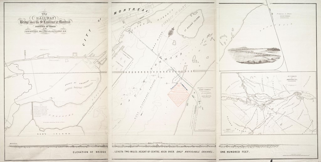
Size of this JPG preview of this PDF file: 800 × 404 pixels. Other resolutions: 320 × 162 pixels | 640 × 323 pixels | 1,024 × 517 pixels | 1,280 × 647 pixels | 2,560 × 1,294 pixels | 7,000 × 3,537 pixels.
Original file (7,000 × 3,537 pixels, file size: 8.08 MB, MIME type: application/pdf)
Captions
Captions
Add a one-line explanation of what this file represents
Summary edit
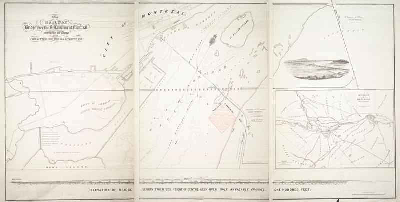
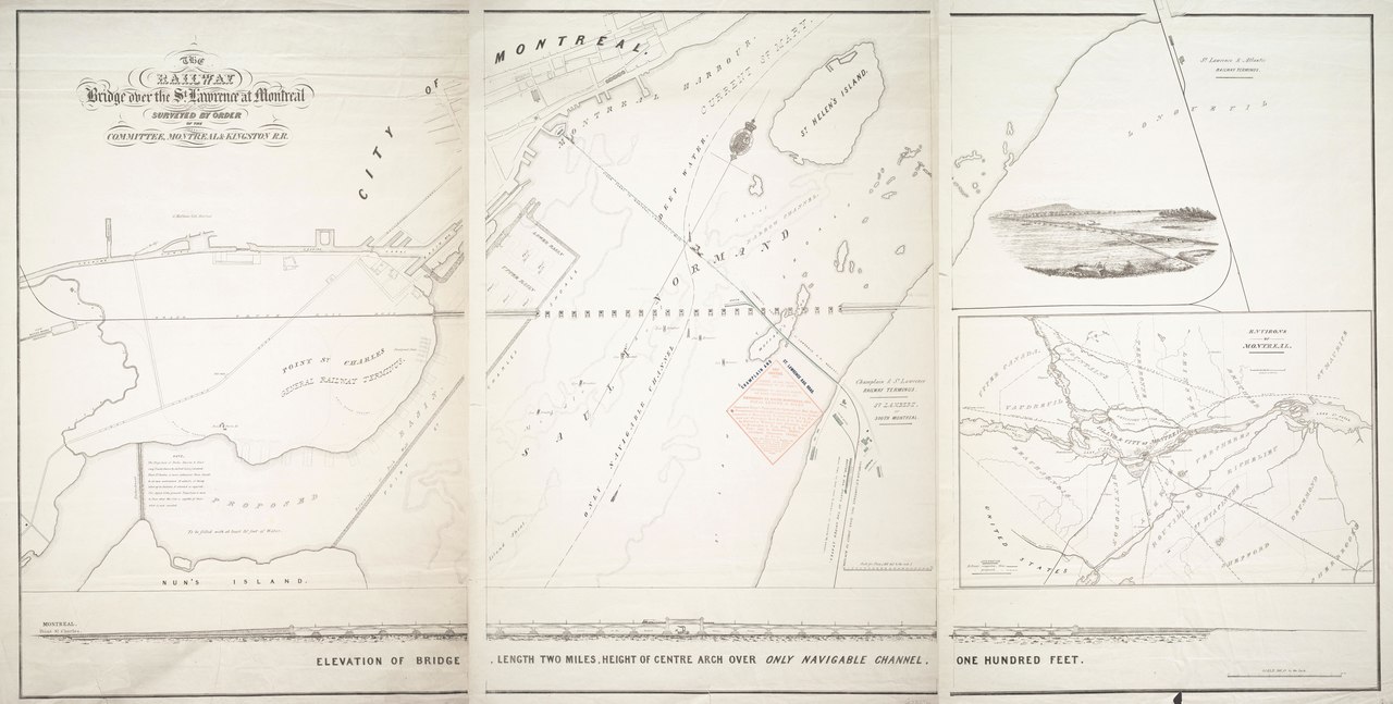
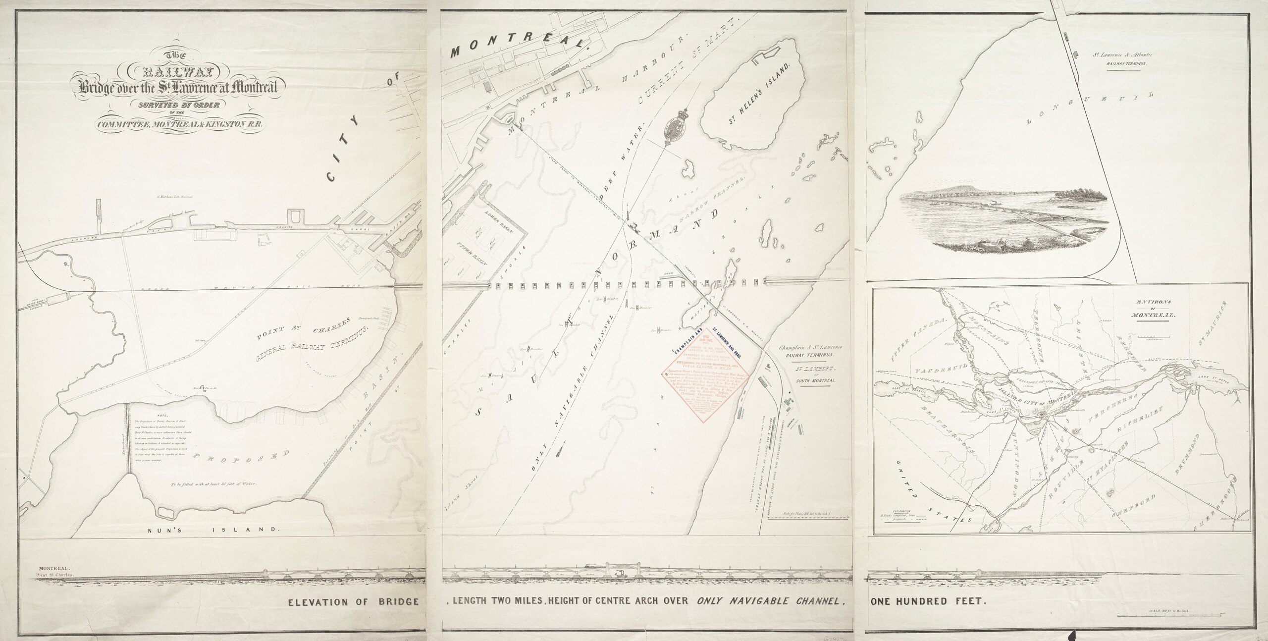
| The railway bridge over the St. Lawrence at Montreal
( |
|
|---|---|
| Author |
Champlain and St. Lawrence Railroad Company |
| Title |
The railway bridge over the St. Lawrence at Montreal |
| Publisher |
Montréal : G. Matthews Lith. |
| Description |
Subjects: Bridges -- Québec (Province) -- Montréal -- Maps.; Railroads -- Québec (Province) -- Montréal -- Maps.; Pont Victoria (Montréal, Québec) -- History -- Maps.; Montréal (Québec) -- Maps.; McGill University Library Digitized Title; Montreal Maps Project; Bridges; Railroads |
| Language | English |
| Publication date | 1852 |
| Current location |
IA Collections: mcgilluniversity; mcgilluniversityrarebooks; toronto |
| Accession number |
McGillLibrary-rbsc_railway_lawrence_G3454M651852C5-16683 |
| Source |
|
Licensing edit
|
This work is in the public domain in its country of origin and other countries and areas where the copyright term is the author's life plus 100 years or fewer. This work is in the public domain in the United States because it was published (or registered with the U.S. Copyright Office) before January 1, 1929. | |
| This file has been identified as being free of known restrictions under copyright law, including all related and neighboring rights. | |
File history
Click on a date/time to view the file as it appeared at that time.
| Date/Time | Thumbnail | Dimensions | User | Comment | |
|---|---|---|---|---|---|
| current | 18:52, 1 January 2021 |  | 7,000 × 3,537 (8.08 MB) | Fæ (talk | contribs) | IA Query "subject:maps date:[1000 TO 1869] " McGillLibrary-rbsc_railway_lawrence_G3454M651852C5-16683 Category:Old maps (COM:IA books#query) (1852 #360) |
You cannot overwrite this file.
File usage on Commons
The following page uses this file: