File:Triborough Bridge Playgrounds td (2023-08-25) 015 - B Play Area.jpg

Size of this preview: 800 × 533 pixels. Other resolutions: 320 × 213 pixels | 640 × 427 pixels | 1,024 × 683 pixels | 1,280 × 853 pixels | 2,560 × 1,707 pixels | 5,472 × 3,648 pixels.
Original file (5,472 × 3,648 pixels, file size: 8.04 MB, MIME type: image/jpeg)
Captions
Captions
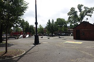
Play Area, Triborough Bridge Playground B, Hoyt Avenue S and 21st Street, Astoria, Queens.
Summary edit
_015_-_B_Play_Area.jpg&action=edit§ion=1)
| Description |
English: The play area or playground at the southwest corner of Triborough Bridge Playground B, across from Astoria Park at the northeast corner of of Hoyt Avenue S and 21st Street in Astoria, Queens. The play area has all the looks and features of a drab Giuliani-era 1990s city playground, which it likely is. Note the frog sprinkler splash pad, similar to other playgrounds such as Farm Playground and Holy Cow Playground both in Fresh Meadows. |
| Date | |
| Source | Own work |
| Author | Tdorante10 |
_28.jpg)
| Camera location | | View this and other nearby images on: OpenStreetMap |
|---|
_015_-_B_Play_Area.jpg¶ms=040.775000_N_-073.922500_E_globe:Earth_type:camera__&language=en)
Licensing edit
_015_-_B_Play_Area.jpg&action=edit§ion=2)
I, the copyright holder of this work, hereby publish it under the following license:
This file is licensed under the Creative Commons Attribution-Share Alike 4.0 International license.
- You are free:
- to share – to copy, distribute and transmit the work
- to remix – to adapt the work
- Under the following conditions:
- attribution – You must give appropriate credit, provide a link to the license, and indicate if changes were made. You may do so in any reasonable manner, but not in any way that suggests the licensor endorses you or your use.
- share alike – If you remix, transform, or build upon the material, you must distribute your contributions under the same or compatible license as the original.
File history
Click on a date/time to view the file as it appeared at that time.
| Date/Time | Thumbnail | Dimensions | User | Comment | |
|---|---|---|---|---|---|
| current | 17:23, 9 September 2023 | | 5,472 × 3,648 (8.04 MB) | Tdorante10 (talk | contribs) | Uploaded own work with UploadWizard |
You cannot overwrite this file.
File usage on Commons
The following page uses this file:
_015_-_B_Play_Area.jpg&oldid=813991068)