File:Txu-oclc-6595921-nc30-15 crop southwest.jpg

Size of this preview: 800 × 427 pixels. Other resolutions: 320 × 171 pixels | 640 × 341 pixels | 1,341 × 715 pixels.
Original file (1,341 × 715 pixels, file size: 1.36 MB, MIME type: image/jpeg)
Captions
Captions
Add a one-line explanation of what this file represents
| Description |
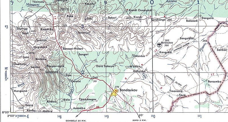
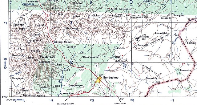
English: US Army map of West Africa, specifically the area along northern border of modern Ghana and Cote d'Ivoire (then Gold Coast Colony and French West Africa). |
| Date | |
| Source | |
| Author |
|
| This is a retouched picture, which means that it has been digitally altered from its original version. Modifications: crop. The original can be viewed here: Txu-oclc-6595921-nc30-15.jpg:
|
This file is a work of a U.S. Army soldier or employee, taken or made as part of that person's official duties. As a work of the U.S. federal government, it is in the public domain in the United States.
|
 |
Original upload log edit
This image is a derivative work of the following images:
- Image:Txu-oclc-6595921-nc30-15.jpg licensed with PD-USGov-Military-Army
- 2008-09-13T01:15:15Z T L Miles 5000x3785 (5264461 Bytes) {{Information |Description={{en|1=US Army map of West Africa, specifically the area along northern border of modern Ghana and Cote d'Ivoire (then Gold Coast Colony and French West Africa).}} |Source=http://www.lib.utexas.edu/
Uploaded with derivativeFX
File history
Click on a date/time to view the file as it appeared at that time.
| Date/Time | Thumbnail | Dimensions | User | Comment | |
|---|---|---|---|---|---|
| current | 01:22, 13 September 2008 | | 1,341 × 715 (1.36 MB) | T L Miles (talk | contribs) | {{Information |Description={{en|1=US Army map of West Africa, specifically the area along northern border of modern Ghana and Cote d'Ivoire (then Gold Coast Colony and French West Africa).}} |Source=*Image:Txu-oclc-6595921-nc30-15.jpg |Date=2008-09- |
You cannot overwrite this file.
File usage on Commons
There are no pages that use this file.
File usage on other wikis
The following other wikis use this file: