File:UBBasel Map 1629 Kartenslg Mappe 236-23 castelli ad Sandflitam.tiff

Size of this JPG preview of this TIF file: 800 × 577 pixels. Other resolutions: 320 × 231 pixels | 640 × 461 pixels | 1,024 × 738 pixels | 1,280 × 923 pixels | 2,560 × 1,846 pixels | 9,560 × 6,893 pixels.

Original file (9,560 × 6,893 pixels, file size: 188.56 MB, MIME type: image/tiff, 2 pages)
Captions
Captions
Add a one-line explanation of what this file represents
Summary edit
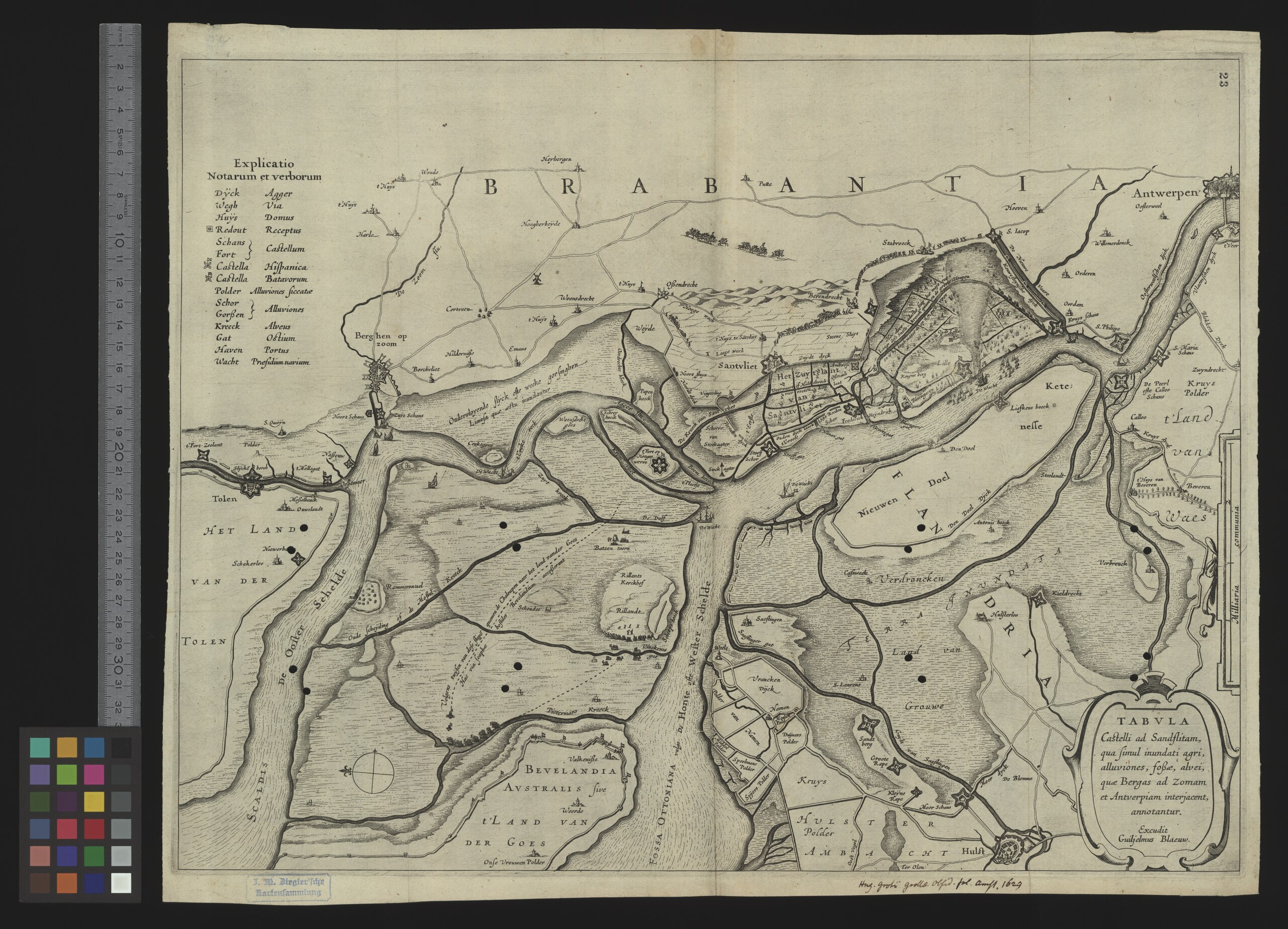
| Title |
Tabula castelli ad Sandflitam |
|||||||||||||||||||||||
| Description |
Tabula castelli ad Sandflitam : qua simul inundati agri, alluviones, fossae, alvei, quae Bergas ad Zomam et et Antverpiam interjacent annotantur / excudit Guiljelmus Blaeuw |
|||||||||||||||||||||||
| Date | ||||||||||||||||||||||||
| Source | 10.3931/e-rara-12801 : Info: Kartenportal.CH | |||||||||||||||||||||||
| Creator |
Willem Janszoon Blaeu |
|||||||||||||||||||||||
| Permission (Reusing this file) |
|
|||||||||||||||||||||||
| Geotemporal data | ||||||||||||||||||||||||
| Scale | Ca. 1:80 000 | |||||||||||||||||||||||
| Bounding box |
|
|||||||||||||||||||||||
| Georeferencing | If inappropriate please set warp_status = skip to hide. | |||||||||||||||||||||||
| Bibliographic data | ||||||||||||||||||||||||
| Language | lat | |||||||||||||||||||||||
| Printed by |
Amsterdam, excudit Guiljelmus Blaeuw |
|||||||||||||||||||||||
| Archival data | ||||||||||||||||||||||||
| Collection |
|
|||||||||||||||||||||||
| Accession number |
Basel UB, Kartenslg Mappe 236:23 |
|||||||||||||||||||||||
| Dimensions | height: 38 cm (14.9 in); width: 50 cm (19.6 in) | |||||||||||||||||||||||
| Medium | Kupferdruck | |||||||||||||||||||||||
| Notes | Titelkartusche unten rechts, Massstabsleiste Mitte rechts, Legende oben links / Ostorientiert | |||||||||||||||||||||||
| Other versions | ||||||||||||||||||||||||


File history
Click on a date/time to view the file as it appeared at that time.
| Date/Time | Thumbnail | Dimensions | User | Comment | |
|---|---|---|---|---|---|
| current | 10:50, 25 August 2015 |  | 9,560 × 6,893, 2 pages (188.56 MB) | Basel University Library (talk | contribs) | GWToolset: Creating mediafile for Basel University Library. |
You cannot overwrite this file.
File usage on Commons
The following 3 pages use this file:
File usage on other wikis
The following other wikis use this file:
- Usage on nl.wikipedia.org