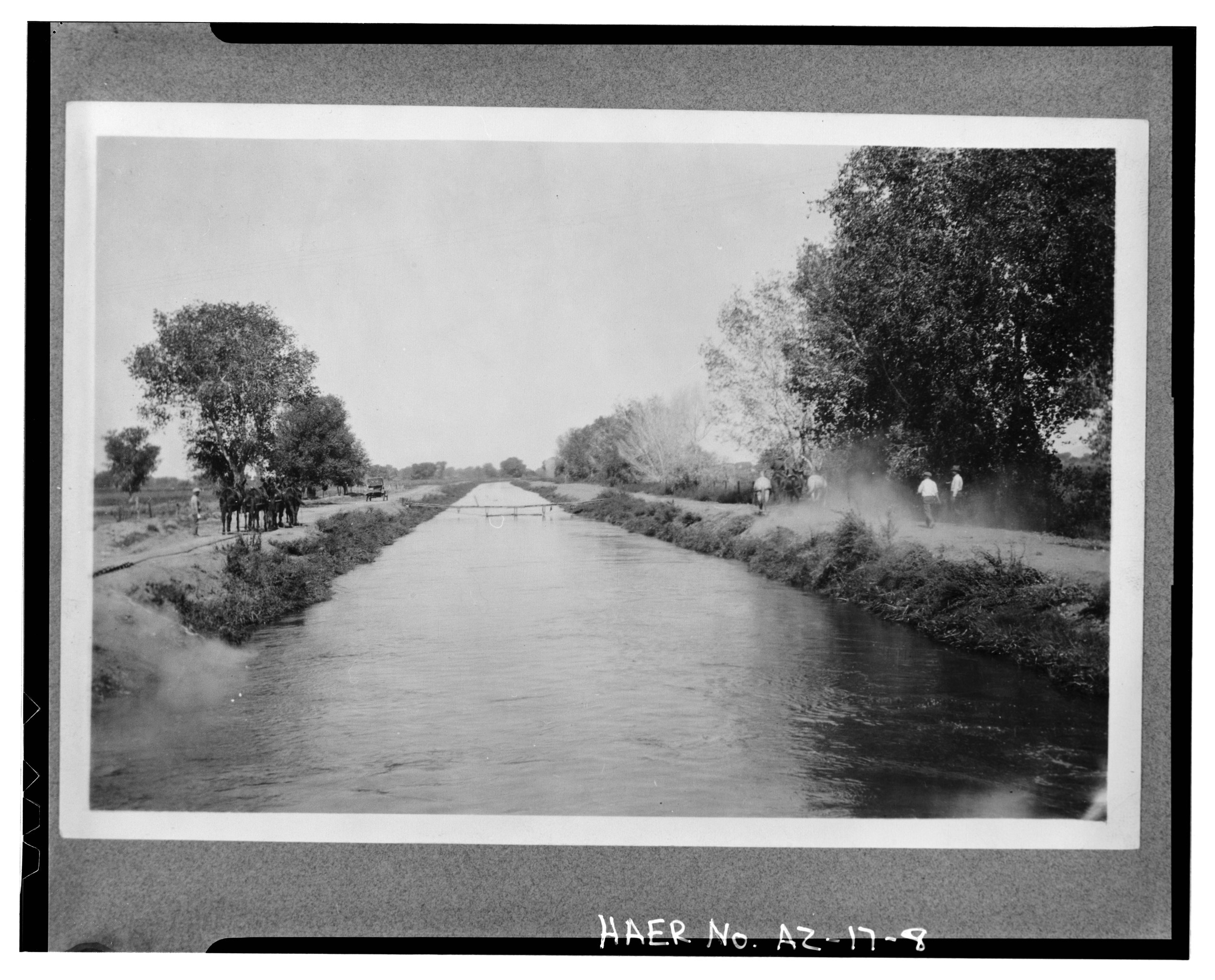
File:VIEW SHOWING THE DEMOSSING OF GRAND CANAL (LOCATION UNKNOWN). AT TEAM OF HORSES ON OPPOSITE BANKS OF THE CANAL DRAG A CHAIN BETWEEN THEM ALONG THE BOTTOM OF THE CANAL, WHICH PULLS HAER ARIZ,7-TEMP,8-8.tif

Size of this JPG preview of this TIF file: 744 × 600 pixels. Other resolutions: 298 × 240 pixels | 596 × 480 pixels | 953 × 768 pixels | 1,270 × 1,024 pixels | 2,540 × 2,048 pixels | 5,000 × 4,031 pixels.
Original file (5,000 × 4,031 pixels, file size: 19.22 MB, MIME type: image/tiff)
Captions
Captions
Add a one-line explanation of what this file represents
Summary edit
| Title |
VIEW SHOWING THE DEMOSSING OF GRAND CANAL (LOCATION UNKNOWN). AT TEAM OF HORSES ON OPPOSITE BANKS OF THE CANAL DRAG A CHAIN BETWEEN THEM ALONG THE BOTTOM OF THE CANAL, WHICH PULLS THE MOSS AND WEEDS LOOSE. THE PLANS THEN FLOAT DOWN THE CANAL AND ARE CAUGHT IN A SCREEN AND REMOVED. Photographer unknown, 1923 - Grand Canal, North side of Salt River, Tempe, Maricopa County, AZ |
|||
| Depicted place | Arizona; Maricopa County; Tempe | |||
| Dimensions | 4 x 5 in. | |||
| Current location |
Library of Congress Prints and Photographs Division Washington, D.C. 20540 USA http://hdl.loc.gov/loc.pnp/pp.print |
|||
| Accession number |
HAER ARIZ,7-TEMP,8-8 |
|||
| Credit line |
|
|||
| Source | https://www.loc.gov/pictures/item/az0239.photos.009742p | |||
| Permission (Reusing this file) |
|

| Camera location | | View this and other nearby images on: OpenStreetMap |
|---|
File history
Click on a date/time to view the file as it appeared at that time.
| Date/Time | Thumbnail | Dimensions | User | Comment | |
|---|---|---|---|---|---|
| current | 19:48, 28 June 2014 |  | 5,000 × 4,031 (19.22 MB) | Fæ (talk | contribs) | GWToolset: Creating mediafile for Fæ. HABS batch upload 26 June 2014 (151:200) |
You cannot overwrite this file.
File usage on Commons
The following page uses this file: