File:Vista de Cádiz y sus contornos hacia 1813.jpg
Size of this preview: 667 × 600 pixels. Other resolutions: 267 × 240 pixels | 534 × 480 pixels | 900 × 809 pixels.
Original file (900 × 809 pixels, file size: 175 KB, MIME type: image/jpeg)
Captions
Captions
Add a one-line explanation of what this file represents
Summary edit
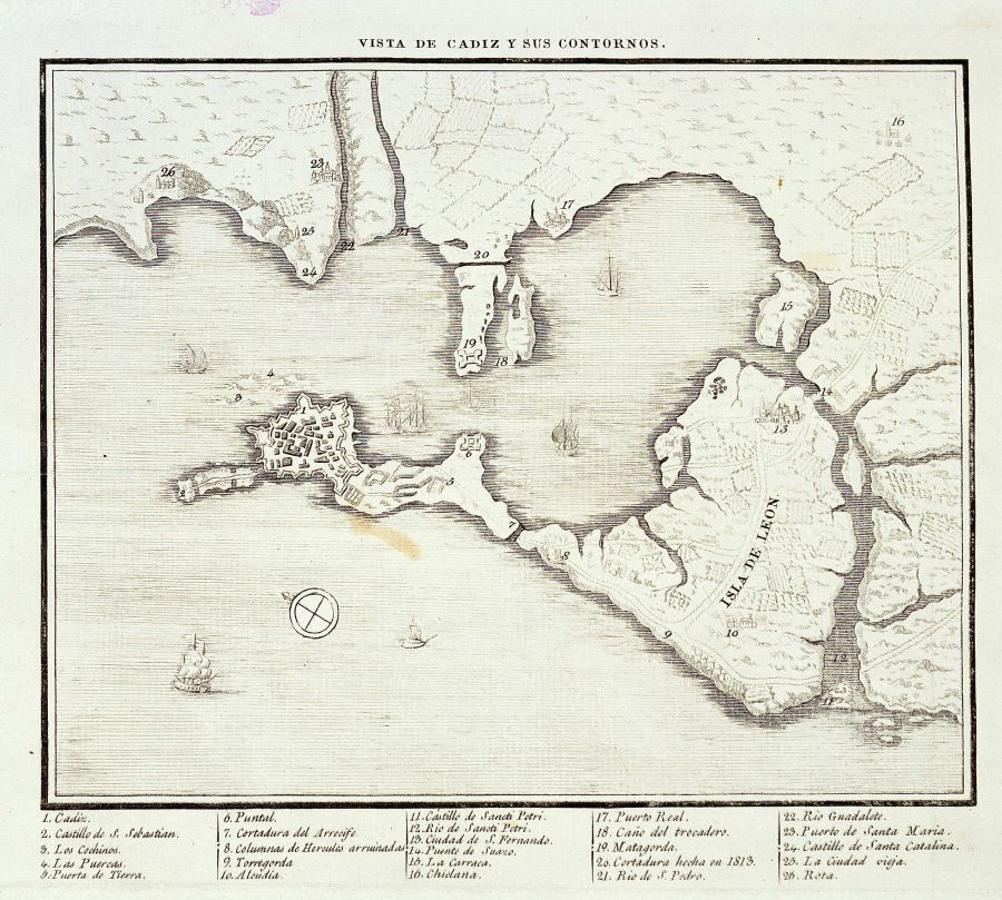
Español: Mapa de 1813
Historical map of Cadiz Bay, taken around 1813.
Licensing edit
|
This work is in the public domain in its country of origin and other countries and areas where the copyright term is the author's life plus 100 years or fewer. | |
| This file has been identified as being free of known restrictions under copyright law, including all related and neighboring rights. | |
File history
Click on a date/time to view the file as it appeared at that time.
| Date/Time | Thumbnail | Dimensions | User | Comment | |
|---|---|---|---|---|---|
| current | 11:31, 31 December 2006 | | 900 × 809 (175 KB) | Seges~commonswiki (talk | contribs) | Historical map of Cadiz Bay, taken around 1813. Category:Cadiz |
You cannot overwrite this file.
File usage on Commons
The following 3 pages use this file:
File usage on other wikis
The following other wikis use this file:
- Usage on ast.wikipedia.org
- Usage on azb.wikipedia.org
- Usage on ca.wikipedia.org
- Usage on en.wikipedia.org
- Usage on es.wikipedia.org
- Isla de León
- Manuel Blanco Encalada
- Puente Zuazo
- Batalla de Chiclana
- Cortes de Cádiz
- Poza de Santa Isabel
- San Fernando (Cádiz)
- James Chaytor
- Batalla de la Poza de Santa Isabel
- Anexo:Relación de diputados que se encontraron en la Real isla de León el día 24 de septiembre de 1810
- Acción del 7 de abril de 1800
- Usage on fr.wikipedia.org
- Usage on fr.wiktionary.org
- Usage on it.wikipedia.org
- Usage on ja.wikipedia.org
- Usage on nl.wikipedia.org
- Usage on pt.wikipedia.org
- Usage on ru.wikipedia.org
- Usage on www.wikidata.org
- Usage on zh.wikipedia.org