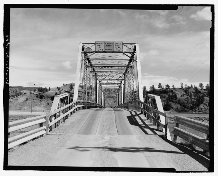
File:West portal; view to east - Missouri River Bridge, Spanning Missouri River at Bridge Street, Craig, Lewis and Clark County, MT HAER MT-112-8.tif
Size of this JPG preview of this TIF file: 742 × 600 pixels. Other resolutions: 297 × 240 pixels | 594 × 480 pixels | 951 × 768 pixels | 1,267 × 1,024 pixels | 2,535 × 2,048 pixels | 5,247 × 4,240 pixels.
Original file (5,247 × 4,240 pixels, file size: 21.22 MB, MIME type: image/tiff)
Captions
Captions
Add a one-line explanation of what this file represents
Summary edit
| West portal; view to east - Missouri River Bridge, Spanning Missouri River at Bridge Street, Craig, Lewis and Clark County, MT | ||||
|---|---|---|---|---|
| Photographer |
Related names:
|
|||
| Title |
West portal; view to east - Missouri River Bridge, Spanning Missouri River at Bridge Street, Craig, Lewis and Clark County, MT |
|||
| Description |
English: Missouri River Bridge, spanning the Missouri River at Bridge Street in Craig — Lewis and Clark County, Montana.
|
|||
| Depicted place | Montana; Lewis and Clark County; Craig | |||
| Date | Documentation compiled after 1968 | |||
| Dimensions | 4 x 5 in. | |||
| Current location |
Library of Congress Prints and Photographs Division Washington, D.C. 20540 USA http://hdl.loc.gov/loc.pnp/pp.print |
|||
| Accession number |
HAER MT-112-8 |
|||
| Credit line |
|
|||
| Notes |
|
|||
| Source | http://lcweb2.loc.gov/master/pnp/habshaer/mt/mt0400/mt0425/photos/198102pu.tif | |||
| Permission (Reusing this file) |
|
|||

| Object location | | View this and other nearby images on: OpenStreetMap |
|---|
File history
Click on a date/time to view the file as it appeared at that time.
| Date/Time | Thumbnail | Dimensions | User | Comment | |
|---|---|---|---|---|---|
| current | 20:20, 28 July 2014 |  | 5,247 × 4,240 (21.22 MB) | Fæ (talk | contribs) | GWToolset: Creating mediafile for Fæ. HABS 24 July 2014 (2001:2300) |
You cannot overwrite this file.
File usage on Commons
The following page uses this file: