Template:Potd/2012-08-25 (en)

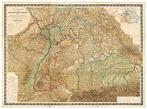
Wall map of Southwestern Germany, which includes the Kingdom of Bavaria, Württemberg Principalities of Baden and Hessen, the Principality of Hohenzollern, and the Imperial territory of Alsace-Lorraine, 1875. Restored by Dr Heinrich Moehl.
This is the English translation of the Picture of the day description page from 25 August 2012.
Wall map of Southwestern Germany, which includes the Kingdom of Bavaria, Württemberg Principalities of Baden and Hessen, the Principality of Hohenzollern, and the Imperial territory of Alsace-Lorraine, 1875. Restored by Dr Heinrich Moehl.
Descriptions in other languages: