Category:1590s maps of Norway
Countries of Europe: Albania · Armenia‡ · Austria · Belgium · Bosnia and Herzegovina · Bulgaria · Croatia · Cyprus‡ · Denmark · Estonia · Finland · France‡ · Georgia‡ · Germany · Greece · Hungary · Iceland · Republic of Ireland · Italy · Lithuania · Netherlands‡ · Norway · Poland · Portugal‡ · Romania · Russia‡ · Spain‡ · Sweden · Turkey‡ · Ukraine
‡: partly located in Europe
‡: partly located in Europe
Media in category "1590s maps of Norway"
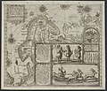
The following 11 files are in this category, out of 11 total.
-
 1598 map of the Polar Regions by Willem Barentsz.jpg 13,719 × 10,160; 30.66 MB
-
 Barentskartet, 1598 (12068020364).jpg 2,842 × 2,091; 3.85 MB
-
 Barentsz Full Map.jpg 1,000 × 742; 258 KB
-
 Finnmark - no-nb krt 00728.jpg 8,417 × 5,983; 20.88 MB
-
 Forminsket utgave av Barentskartet - no-nb krt 00487.jpg 4,418 × 3,449; 3.45 MB
-

-

-
 Linschoten Map of Scandinavia.jpg 1,536 × 1,316; 540 KB
-
 Linschotens nordenkart, 1601 (12067624705) (2).jpg 4,400 × 3,609; 22.96 MB
-
 Linschotens nordenkart, 1601 (12067624705).jpg 4,037 × 3,455; 22.29 MB
-


.jpg)


_door_Willem_Barendsz_(titel_op_object),_NG-800.jpg)

_(2).jpg)
.jpg)
