Category:1600s maps of Turkey
Countries of Europe: Albania · Belgium · Bosnia and Herzegovina · Croatia · Cyprus‡ · Denmark · France‡ · Georgia‡ · Germany · Greece · Republic of Ireland · Italy · Lithuania · Netherlands‡ · Norway · Portugal‡ · Romania · Russia‡ · Serbia · Spain‡ · Switzerland · Turkey‡ · Ukraine
‡: partly located in Europe
‡: partly located in Europe
Subcategories
This category has only the following subcategory.
M
Media in category "1600s maps of Turkey"
The following 7 files are in this category, out of 7 total.
-
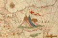
 Map of Turkey (1600) a closer view.jpg 800 × 600; 155 KB
-
 Map of Turkey (1600).jpg 800 × 1,067; 168 KB
-
 1600 map - Natolia oder Klein Asia.tif 4,363 × 3,299; 7.94 MB
-

-
 Natoliae Quae Olim Asia Minor Nova Descriptio.jpg 5,560 × 7,725; 14.07 MB
-
-
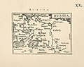 Ortelius.Russia.jpg 1,600 × 1,267; 401 KB
_a_closer_view.jpg)
.jpg)


