Category:1600s maps of Denmark
Media in category "1600s maps of Denmark"
The following 3 files are in this category, out of 3 total.
-
 Map of Denmark (1600).jpg 800 × 600; 140 KB
-
 UBBasel Map Dänemark Südschweden 1600 Kartenslg Mappe 247-30.tif 7,953 × 5,563, 2 pages; 126.6 MB
-
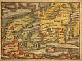
 Maps of Denmark and of the Cimbrian (Jutland) Peninsula by Abraham Ortelius.jpeg 3,071 × 2,343; 2.28 MB
.jpg)
_Peninsula_by_Abraham_Ortelius.jpeg)