Category:17th-century maps of Denmark
Countries of Europe: Albania · Armenia‡ · Austria · Azerbaijan‡ · Belarus · Belgium · Bosnia and Herzegovina · Bulgaria · Croatia · Cyprus‡ · Czech Republic · Denmark · Estonia · Finland · France‡ · Georgia‡ · Germany · Greece · Hungary · Iceland · Republic of Ireland · Italy · Latvia · Lithuania · Luxembourg · Malta · Montenegro · Netherlands‡ · Norway · Poland · Portugal‡ · Romania · Russia‡ · Serbia · Slovakia · Slovenia · Spain‡ · Sweden · Switzerland · Turkey‡ · Ukraine · United Kingdom
Specific status: Isle of Man – Limited recognition: Abkhazia‡
‡: partly located in Europe
Specific status: Isle of Man – Limited recognition: Abkhazia‡
‡: partly located in Europe
Subcategories
This category has the following 13 subcategories, out of 13 total.
#
- 1600s maps of Denmark (3 F)
- 1620s maps of Denmark (3 F)
- 1630s maps of Denmark (2 F)
- 1640s maps of Denmark (5 F)
- 1650s maps of Denmark (16 F)
- 1660s maps of Denmark (3 F)
- 1670s maps of Denmark (3 F)
- 1680s maps of Denmark (7 F)
- 1690s maps of Denmark (1 F)
.
C
- 17th-century maps of Copenhagen (27 F)
D
Media in category "17th-century maps of Denmark"
The following 8 files are in this category, out of 8 total.
-
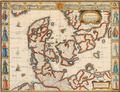 John Speed - The Kingdome of Denmarke.png 1,894 × 1,453; 7.01 MB
-
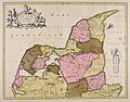
 Nicolaes Visscher II - Regni Daniæ.png 3,382 × 2,787; 18.25 MB
-
 Carte de la Mer de Dannemark - no-nb krt 00762.jpg 11,741 × 7,415; 27.75 MB
-
 CCI21062015 0000x.jpg 1,200 × 1,683; 993 KB
-
 Dania regnum - CBT 5872009.jpg 5,588 × 4,760; 8.69 MB
-
 Jutia septentrionalis - CBT 5872049.jpg 6,048 × 4,738; 7.08 MB
-
 Totius Iutiae generalis accurata delincatio - CBT 5872030.jpg 6,014 × 4,716; 6.94 MB
-
 UBBasel Map 1659-1688 Kartenslg Mappe 247-42.tif 11,328 × 8,766, 2 pages; 284.13 MB


