Category:17th-century maps of Romania
Countries of Europe: Albania · Armenia‡ · Austria · Azerbaijan‡ · Belarus · Belgium · Bosnia and Herzegovina · Bulgaria · Croatia · Cyprus‡ · Czech Republic · Denmark · Estonia · Finland · France‡ · Georgia‡ · Germany · Greece · Hungary · Iceland · Republic of Ireland · Italy · Latvia · Lithuania · Luxembourg · Malta · Montenegro · Netherlands‡ · Norway · Poland · Portugal‡ · Romania · Russia‡ · Serbia · Slovakia · Slovenia · Spain‡ · Sweden · Switzerland · Turkey‡ · Ukraine
Specific status: Isle of Man – Limited recognition: Abkhazia‡
‡: partly located in Europe
Specific status: Isle of Man – Limited recognition: Abkhazia‡
‡: partly located in Europe
Subcategories
This category has the following 8 subcategories, out of 8 total.
- 1600s maps of Romania (3 F)
- 1610s maps of Romania (1 F)
- 1640s maps of Romania (1 F)
- 1650s maps of Romania (1 F)
- 1660s maps of Romania (2 F)
- 1680s maps of Romania (1 F)
.
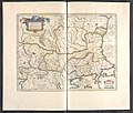
Media in category "17th-century maps of Romania"
The following 3 files are in this category, out of 3 total.
-
 Ca. 1627 map of Transylvania.jpg 7,649 × 5,993; 6.38 MB
-
-
 Harta veche Codrii Vlăsiei de prin 16xx.jpg 1,600 × 867; 413 KB
.2.(30).jpg)
