Category:17th-century maps of Bosnia and Herzegovina
Countries of Europe: Albania · Armenia‡ · Austria · Azerbaijan‡ · Belarus · Belgium · Bosnia and Herzegovina · Bulgaria · Croatia · Cyprus‡ · Czech Republic · Denmark · Estonia · Finland · France‡ · Georgia‡ · Germany · Greece · Hungary · Iceland · Republic of Ireland · Italy · Latvia · Lithuania · Luxembourg · Malta · Montenegro · Netherlands‡ · Norway · Poland · Portugal‡ · Romania · Russia‡ · Serbia · Slovakia · Slovenia · Spain‡ · Sweden · Switzerland · Turkey‡ · Ukraine · United Kingdom
Specific status: Isle of Man – Limited recognition: Abkhazia‡
‡: partly located in Europe
Specific status: Isle of Man – Limited recognition: Abkhazia‡
‡: partly located in Europe
Subcategories
This category has the following 4 subcategories, out of 4 total.
Media in category "17th-century maps of Bosnia and Herzegovina"
The following 2 files are in this category, out of 2 total.
-
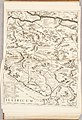 Atlante Veneto Volume 1 145.jpg 6,703 × 9,808; 7.81 MB
-
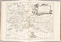 Atlante Veneto Volume 2 050.jpg 10,284 × 7,024; 7.5 MB

