Category:17th-century maps of Poland
Countries of Europe: Albania · Armenia‡ · Austria · Azerbaijan‡ · Belarus · Belgium · Bosnia and Herzegovina · Bulgaria · Croatia · Cyprus‡ · Czech Republic · Denmark · Estonia · Finland · France‡ · Georgia‡ · Germany · Greece · Hungary · Iceland · Republic of Ireland · Italy · Latvia · Lithuania · Luxembourg · Malta · Montenegro · Netherlands‡ · Norway · Poland · Portugal‡ · Romania · Russia‡ · Serbia · Slovakia · Slovenia · Spain‡ · Sweden · Switzerland · Turkey‡ · Ukraine · United Kingdom
Specific status: Gibraltar · Isle of Man – Limited recognition: Abkhazia‡
‡: partly located in Europe
Specific status: Gibraltar · Isle of Man – Limited recognition: Abkhazia‡
‡: partly located in Europe
Subcategories
This category has the following 9 subcategories, out of 9 total.
- 1620s maps of Poland (2 F)
- 1680s maps of Poland (2 F)
*
- 17th-century maps of Pomerania (21 F)
1
- 17th-century maps of Prussia (13 F)
Media in category "17th-century maps of Poland"
The following 15 files are in this category, out of 15 total.
-
 Map of Hungary and its region (1600) north west.jpg 800 × 600; 168 KB
-
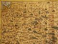
 Map of Poland and Lithuania by Abraham Ortelius.jpeg 1,580 × 1,176; 593 KB
-

-

-
 Regni Poloniae et Ducatus Lithuania (1679).jpg 5,500 × 4,264; 4.01 MB
-
 Eilhard Lubinus map of Pomerania - detail 2.png 1,600 × 1,200; 3.81 MB
-
 Eilhard Lubinus map of Pomerania - detail 3.png 1,600 × 1,200; 3.66 MB
-
 Eilhard Lubinus map of Pomerania - detail 4.png 1,600 × 1,200; 3.59 MB
-
 Eilhard Lubinus map of Pomerania.png 1,600 × 1,200; 3.32 MB
-

-
 Plan Elblaga, 1635.jpg 618 × 611; 352 KB
-

-
-
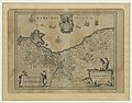
 Pomeraniae Ducatus Tabula2.jpg 4,101 × 3,180; 3.36 MB
-
 Sarmatia Utraque Europaea et Asiatica.jpg 1,705 × 1,500; 564 KB
_north_west.jpg)

.jpg)
.2.(19).jpg)
.jpg)


_-_a_Nicolao_Johannide_Piscatore_;_Sculptum_apud_A._Goos_-_btv1b53235778j_(2_of_3).jpg)

.jpg)


