Category:17th-century maps of Malta
Countries of Europe: Albania · Armenia‡ · Austria · Azerbaijan‡ · Belarus · Belgium · Bosnia and Herzegovina · Bulgaria · Croatia · Cyprus‡ · Czech Republic · Denmark · Estonia · Finland · France‡ · Georgia‡ · Germany · Greece · Hungary · Iceland · Republic of Ireland · Italy · Latvia · Lithuania · Luxembourg · Malta · Montenegro · Netherlands‡ · Norway · Poland · Portugal‡ · Romania · Russia‡ · Serbia · Slovakia · Slovenia · Spain‡ · Sweden · Switzerland · Turkey‡ · Ukraine · United Kingdom
Specific status: Gibraltar · Isle of Man – Limited recognition: Abkhazia‡
‡: partly located in Europe
Specific status: Gibraltar · Isle of Man – Limited recognition: Abkhazia‡
‡: partly located in Europe
Media in category "17th-century maps of Malta"
The following 7 files are in this category, out of 7 total.
-

-

-
 FLAMINUS(1681) p276 Nr.10 - MALTA - INSOLA.jpg 3,088 × 2,049; 3.77 MB
-

-
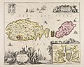 Insulae Melitae vulgò Malte nova et accurata descriptio - CBT 6620406.jpg 5,842 × 4,657; 6.93 MB
-
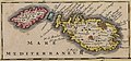 Insulae Maltae et Gozae - CBT 5882690.jpg 1,367 × 640; 440 KB
-

.jpg)
.jpg)
_p276_Nr.10_-_MALTA_-_INSOLA.jpg)
.jpg)


