Category:1650s maps of Denmark
Countries of Europe: Armenia‡ · Belgium · Bosnia and Herzegovina · Bulgaria · Croatia · Cyprus‡ · Denmark · France‡ · Germany · Greece · Hungary · Republic of Ireland · Italy · Latvia · Lithuania · Netherlands‡ · Norway · Poland · Portugal‡ · Romania · Russia‡ · Slovenia · Spain‡ · Sweden · Switzerland · Turkey‡ · Ukraine
‡: partly located in Europe
‡: partly located in Europe
Media in category "1650s maps of Denmark"
The following 24 files are in this category, out of 24 total.
-

-

-
 Royaume de Danemarq - par le Sr Sanson... - btv1b8459060h.jpg 9,034 × 7,222; 10.51 MB
-
 Royaume de Danemarq - par le Sr. Sanson ; R. Cordier Ab. scul. - btv1b53040810w.jpg 7,910 × 6,112; 6.35 MB
-
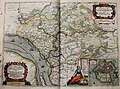
 "Ducatus Sleswici pars borealis. - Author Iohannes Mejerus " (22234101276).jpg 4,442 × 3,099; 2.99 MB
-
 "Ducatus Sleswici pars meridionalis - Author Iohannes Mejerus " (22067658640).jpg 4,416 × 3,071; 2.8 MB
-
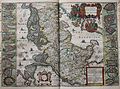
 "Fionia vulgo Funen" (22068681500).jpg 3,970 × 3,098; 1.89 MB
-

-
-

-
 "Pars orientalis praefecturae Hadersleben vulgo dictae baringsijbel " (21632674454).jpg 4,004 × 3,047; 2.18 MB
-

-
 "Aroe Insulae delineatio geometrica - author Iohannes Mejer" (22263616981).jpg 1,976 × 1,344; 458 KB
-
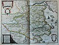
 "Dania regnum" (22070681719).jpg 3,631 × 3,100; 1.87 MB
-

-
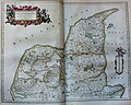
 "Iutia, olim Cimbrica Chersonesus. " (22231350706).jpg 4,077 × 3,152; 2.22 MB
-
 "Lalandia Falstria et Mona Insulae in Mari Balthico" (22069653179).jpg 3,929 × 3,063; 1.7 MB
-
-
 "Praefectura Apenrade et Luntost herde - Iohannes Mejer..." (22241656782).jpg 4,037 × 3,097; 2.25 MB
-
-
-
 "Zeelandia insula danicarum maxima." (22266873331).jpg 3,796 × 3,105; 1.93 MB
-
 Ribe map 1651.jpg 900 × 510; 831 KB
-
 Ripen1651.jpg 3,026 × 1,729; 3.95 MB
.jpg)
.jpg)


.jpg)
.jpg)
.jpg)
.jpg)
.jpg)
.jpg)
.jpg)
_-_btv1b52511195b_(29_of_85).jpg)
.jpg)
.jpg)
.jpg)
.jpg)
.jpg)
.jpg)
.jpg)
.jpg)
.jpg)
.jpg)

