Category:1650s maps of Switzerland
Countries of Europe: Armenia‡ · Belgium · Bosnia and Herzegovina · Bulgaria · Croatia · Cyprus‡ · Denmark · France‡ · Germany · Greece · Hungary · Republic of Ireland · Italy · Latvia · Lithuania · Netherlands‡ · Norway · Poland · Portugal‡ · Romania · Russia‡ · Slovenia · Spain‡ · Sweden · Switzerland · Turkey‡ · Ukraine
‡: partly located in Europe
‡: partly located in Europe
Media in category "1650s maps of Switzerland"
The following 17 files are in this category, out of 17 total.
-
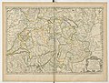
 UBBasel Map 1650 Kartenslg Schw B 169.tif 7,373 × 4,479, 2 pages; 94.5 MB
-
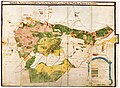
 Topographia Helvetiae, Rhaetiae et Valesiae 1654 (1126637).jpg 5,786 × 4,227; 7.86 MB
-

-
-
 "Das Wiflispur-Gergow - Gerardo Marcatore Auctore" (22066894670).jpg 4,050 × 3,056; 2.87 MB
-

-

-
 "Territorium Basileense cum adjacentibus." (22067138508).jpg 3,846 × 3,072; 2.33 MB
-
 "Zurichgow et Basiliensis provincia." (21633948513).jpg 3,966 × 3,018; 2.69 MB
-
 BasserstorffHKGyger1658.jpg 8,964 × 6,553; 19.12 MB
-
 UBBasel Map 1650-1670 Kartenslg Schw A 127.tif 6,067 × 4,272, 2 pages; 74.18 MB
-
 UBBasel Map 1650-1670 Kartenslg Schw A 73.tif 3,369 × 3,217, 2 pages; 31.03 MB
-
 UBBasel Map 1651 Kartenslg Schw A 125.tif 4,963 × 3,444, 2 pages; 48.93 MB
-
 UBBasel Map 1651 Kartenslg Schw A 137.tif 12,022 × 8,318, 2 pages; 286.12 MB
-
 UBBasel Map 1651 VB A2-1-6.tif 11,929 × 8,757, 2 pages; 298.89 MB
-
 UBBasel Map 1657 Kartenslg Schw A 103.tif 11,133 × 7,220, 2 pages; 230 MB
-
 UBBasel Map 1657 VB A2-1-21a.tif 14,921 × 9,597, 2 pages; 409.71 MB
.jpg)

.jpg)
.jpg)
.jpg)
.jpg)
.jpg)
.jpg)
