Category:1650s maps of Belgium
Countries of Europe: Armenia‡ · Belgium · Bosnia and Herzegovina · Bulgaria · Croatia · Cyprus‡ · Denmark · France‡ · Germany · Greece · Hungary · Republic of Ireland · Italy · Latvia · Lithuania · Netherlands‡ · Norway · Poland · Portugal‡ · Romania · Russia‡ · Slovenia · Spain‡ · Sweden · Switzerland · Turkey‡ · Ukraine
‡: partly located in Europe
‡: partly located in Europe
Media in category "1650s maps of Belgium"
The following 15 files are in this category, out of 15 total.
-
 Leo Belgicus - C.J. Visscher (1650), 6 - BL.jpg 1,364 × 1,087; 1,002 KB
-
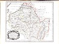 A-3-37-58-Belgium.jpg 3,000 × 2,248; 928 KB
-
 UBBasel Map 1651 Kartenslg Mappe 234-1.tif 4,376 × 3,704, 2 pages; 46.4 MB
-

-
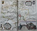
 "Brabantia Ducatus" (22069287410).jpg 3,821 × 2,919; 2.78 MB
-

-
 "(Gante)" (22231069536).jpg 3,444 × 2,933; 2.23 MB
-
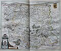
 "Comitatuum Hannoniae et Namurci Descriptio" (21635818283).jpg 3,761 × 2,978; 2.9 MB
-
 "Iprensis Epifcopatus." (22267546321).jpg 3,716 × 3,087; 2.68 MB
-
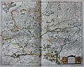
 "Leodiensis dioecesis" (22257678685).jpg 3,876 × 3,023; 2.69 MB
-
 "Namurcum Comitatus - Iohann Surhonio" (22244045122).jpg 3,551 × 2,870; 2.13 MB
-

-

-

-

,_6_-_BL.jpg)

.jpg)
.jpg)
_-_btv1b52511195b_(27_of_85).jpg)
%22_(22231069536).jpg)
.jpg)
.jpg)
.jpg)
.jpg)
.jpg)
.jpg)
.jpg)
.jpg)