Category:1700s maps of Belgium
Countries of Europe: Albania · Armenia‡ · Austria · Azerbaijan‡ · Belgium · Croatia · Denmark · France‡ · Georgia‡ · Germany · Greece · Hungary · Republic of Ireland · Italy · Lithuania · Netherlands‡ · Norway · Portugal‡ · Romania · Russia‡ · Serbia · Slovenia · Spain‡ · Sweden · Switzerland · Turkey‡ · Ukraine
‡: partly located in Europe
‡: partly located in Europe
Subcategories
This category has the following 3 subcategories, out of 3 total.
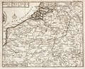
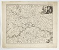
Media in category "1700s maps of Belgium"
The following 7 files are in this category, out of 7 total.
-

-
 Histoire-de-Guillaume-III-MG 0123.tif 4,374 × 3,586; 44.91 MB
-
 Eugene-Henry-Fricx-Table-des-cartes-des-Pays-Bas MG 0562.tif 4,542 × 3,564; 46.35 MB
-
 Fortifikationskarta över Charleroy,1709 - Skoklosters slott - 99059.tif 4,726 × 3,389, 2 pages; 45.85 MB
-
 Kaart van Keerbergen 1705.jpg 1,728 × 2,098; 1.15 MB
-
 Karta över mellersta Belgien, omkring staden Namur, 1650-1700 - Skoklosters slott - 97993.tif 4,163 × 3,587; 42.74 MB
-
 Map - Special Collections University of Amsterdam - OTM- HB-KZL 34.33.13.tif 11,344 × 7,380; 239.52 MB
.jpg)
