Category:1790s maps of Belgium
Countries of Europe: Albania · Armenia‡ · Austria · Belarus · Belgium · Bosnia and Herzegovina · Bulgaria · Croatia · Cyprus‡ · Denmark · Estonia · France‡ · Georgia‡ · Germany · Greece · Hungary · Republic of Ireland · Italy · Latvia · Lithuania · Moldova · Netherlands‡ · Norway · Poland · Portugal‡ · Romania · Russia‡ · Serbia · Slovakia · Slovenia · Spain‡ · Sweden · Switzerland · Turkey‡ · Ukraine · United Kingdom
Limited recognition: Abkhazia‡
‡: partly located in Europe
Limited recognition: Abkhazia‡
‡: partly located in Europe
Media in category "1790s maps of Belgium"
The following 19 files are in this category, out of 19 total.
-
 Plan De La Bataille De Jemappes et des Retranchements des Autrichiens.jpg 6,573 × 4,496; 7.79 MB
-
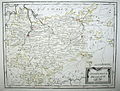
 Reilly 169.jpg 1,182 × 960; 482 KB
-
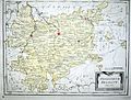
 Reilly 170.jpg 1,124 × 874; 353 KB
-
 Reilly 171.jpg 1,121 × 1,001; 510 KB
-
 Reilly 172.jpg 1,044 × 979; 458 KB
-
 Reilly 173.jpg 1,201 × 912; 504 KB
-
 Reilly 174.jpg 984 × 823; 319 KB
-
 Reilly 176.jpg 1,069 × 964; 424 KB
-
 Reilly 177.jpg 1,659 × 921; 751 KB
-
 Reilly 178.jpg 1,091 × 947; 450 KB
-
 Reilly 178b.jpg 1,128 × 981; 524 KB
-
 Reilly 179.jpg 1,380 × 1,051; 613 KB
-
 Reilly 179b.jpg 1,368 × 1,035; 721 KB
-

-
 Hertogdom brabant, Belgium, Reilly , 1791.jpg 2,899 × 2,080; 1.86 MB
-
 Reilly 269.jpg 1,099 × 1,004; 487 KB
-
 Reilly 270.jpg 500 × 350; 115 KB
-
 Reilly 270b.jpg 1,341 × 939; 607 KB
-
 Reilly 271.jpg 1,209 × 944; 542 KB


